Catalog Archive
Auction 129, Lot 378

"A Map of the West Indies and Middle Continent of America from the latest Observations", Blair, Rev. John

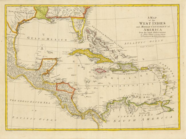
Subject: Gulf of Mexico and Caribbean

Period: 1768 (circa)

Publication: The Chronology and History of the World.

Color: Hand Color

Size:
22.5 x 16.1 inches
57.2 x 40.9 cm
Download High Resolution Image
(or just click on image to launch the Zoom viewer)

This boldly engraved chart of the Gulf of Mexico and the Caribbean is filled with interesting information, with many forts and towns named. The British colony of Georgia extends to the Mississippi River and the Gulf Coast and its boundary with Florida is noted as Limits Stipulated 1738, leaving the Spanish colony of Florida occupying only the peninsula. A line further south is noted as the Southern Bounds [Georgia] by Charter 1665. The southern portion of Florida is shown as a jumble of large islands, named Bay del Spiritu Santo. Texas is named as the New Kingdom of Leon. The map was engraved by Thomas Kitchin.

References:

Condition: B+

There are a few tiny, light spots in the map and short fold separation in the bottom margin. There is a minor tape stain on the paper edge, well away from the map. Linen hinge remnants on verso.

Estimate: $400 - $500

Unsold

Closed on 9/23/2009

Archived