Catalog Archive
Auction 129, Lot 371
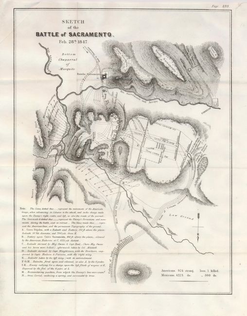
"Sketch of the Battle of Sacramento. Feb. 28th 1847", U.S. Government
Subject: Mexico
Period: 1847 (dated)
Publication: Senate Doc. 1, 30th Congress, 1st Session
Color: Black & White
Size:
9.5 x 12.5 inches
24.1 x 31.8 cm
Download High Resolution Image
(or just click on image to launch the Zoom viewer)
(or just click on image to launch the Zoom viewer)