Catalog Archive
Auction 129, Lot 36

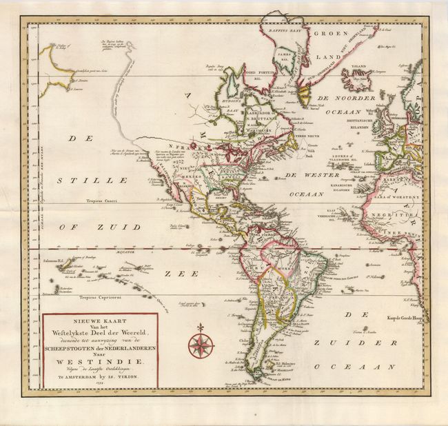
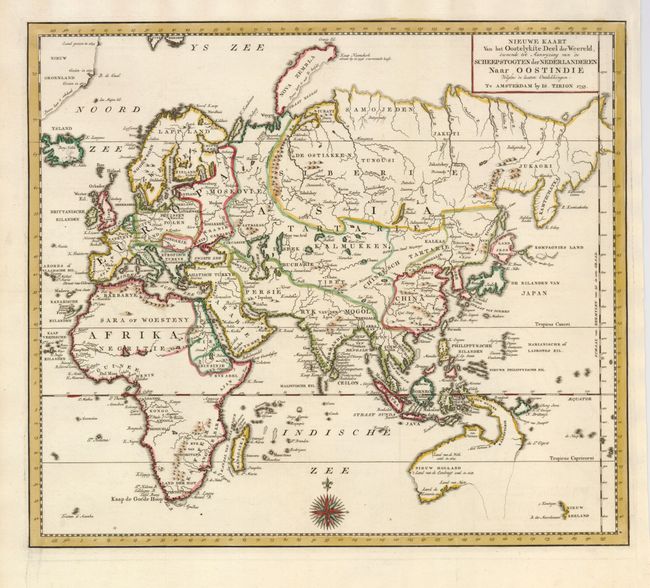
"[Lot of 2] Nieuwe Kaart van het Westelykste Deel der Weereld…naar Westindie [and] Nieuwe Kaart van het Oostelykste Deel de Weereld… naar Oostindie…", Tirion, Isaac

Subject: World

Period: 1753-4 (dated)

Publication:

Color: Hand Color

Size:
14.3 x 13 inches
36.3 x 33 cm
Download High Resolution Image
(or just click on image to launch the Zoom viewer)

This pair of attractive maps cover the world. The map of the Americas displays a speculative River of the West through North America, beginning at the Great Lakes and emptying into the Pacific at about 50° N. latitude. The entire western part of North America is virtually blank. The northwest coastline is delineated by a dotted line terminating with a notation concerning the Russian explorations in 1743 in the region of Alaska, with a nearby coast of Asia. The map of the Eastern Hemisphere provides an excellent view of the still evolving cartography in the Far East. The depiction of East Asia includes an extended landmass beyond the Kamchatka Peninsula, as well as the outdated ideas of Kompagnies Land and Land Jeso. The islands of the Philippines and Indonesia are not well shaped, and Australia is a very odd shape that incorporates New Guinea with most of the southern and eastern coastlines shown as dotted lines. The interior of Africa is mostly blank with the Nile's source correctly located. Both maps are decorated with compass roses and simple title blocks.

References:

Condition: A+

Issued folding and now flattened.

Estimate: $475 - $550

Sold for: $400

Closed on 9/23/2009

Archived