Catalog Archive
Auction 129, Lot 368

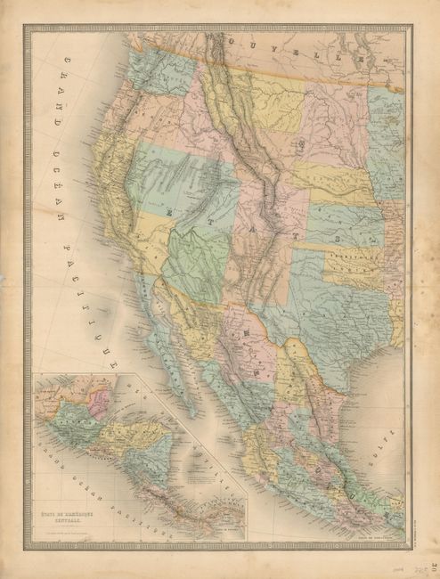
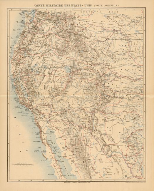
"[Lot of 2] [Untitled - Carte Generale des Etats-Unis et du Mexique...] [and] Carte Militaire des Etats- Unis (Partie Occidentale)",

Subject: Western United States & Mexico

Period: 1868-70 (circa)

Publication:

Color:

Size:
See Description
Download High Resolution Image
(or just click on image to launch the Zoom viewer)

1) This is the western sheet of a two-part map, titled Carte Generale des Etats-Unis et du Mexique Comprenant L'Amerique Centrale et les Antilles, Andriveau-Goujon, Atlas Universel, circa 1868, hand colored (18 x 25"). It covers the western United States and Mexico with a large inset of Central America. It features some truly unusual and erroneous state and territory configurations. The western boundary of California follows the Sierra Nevadas and then extends to include the southern portion of present-day Nevada, which contains Las Vegas (Vegas de Quintana). The border between Montana and Idaho follows a range of mountains named Mts. Coeur d'Alene. The border between Utah and Nevada is too far west. The large Dacotah territory is shown before it was divided in 1889, and Oklahoma is Indian Territory. The overland routes to Santa Fe, Mexico and California are shown as well as notations of native tribes and topography. It has complete borders and stands well on its own.

2) Carte Militaire des Etats- Unis (Partie Occidentale), by J. Geisendorfer, published by Furne, Jouvel et Cie, circa 1870, printed color (16 x 19.5"). This military map shows the western states shortly after the Civil War. The details include roads, railroads, Indian tribes, villages and reservations, military forts and encampments. It is also the western sheet of a two-part map, with complete borders, so it stands on its own.

References:

Condition: B+

Some minor toning with some edge tears and damp stains in margins.

Estimate: $250 - $300

Unsold

Closed on 9/23/2009

Archived