Catalog Archive
Auction 129, Lot 351

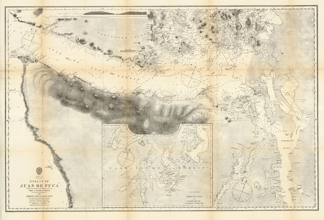
"Strait of Juan de Fuca Surveyed by Captain Henry Kellett 1847 … Haro & Rosario Straits… Admiralty Inlet and Puget Sound", U.S. Hydrographic Office

Subject: Washington

Period: 1858 (dated)

Publication:

Color: Black & White

Size:
32.5 x 22 inches
82.6 x 55.9 cm
Download High Resolution Image
(or just click on image to launch the Zoom viewer)

This uncommon lithographed chart details the Strait of Juan de Fuca, Admiralty Inlet, Puget Sound and the waters in the vicinity of the San Juan Islands. It includes an inset chart "Continuation of Admiralty Inlet and Puget Sound." Details on the map include thousands of soundings given in fathoms, hachuring of the mountains surrounding the strait, with numerous tribal lands located and named. A few settlements are noted: Victoria, Olympia, Fort Nisqually, Fort Steilcoom, and Seattle. This is a very early mention of Seattle, which was not incorporated until 1865. The incorporation was disbanded in 1867 due to unrest and was not permanently renewed for another two years. Much of the map's cartography is credited to the U.S. Exploring Expeditions of 1841 and 1853. The map is dated 1858, but a note that states "Magnetic Variation in 1866" indicates this is a revised edition from the late 1860s.

References:

Condition: B+

A very nice example that would be fine save for a little folding toning along two folds with some archival tape reinforcement on verso. Folding as issued, blank verso.

Estimate: $250 - $300

Sold for: $275

Closed on 9/23/2009

Archived