Catalog Archive
Auction 129, Lot 331

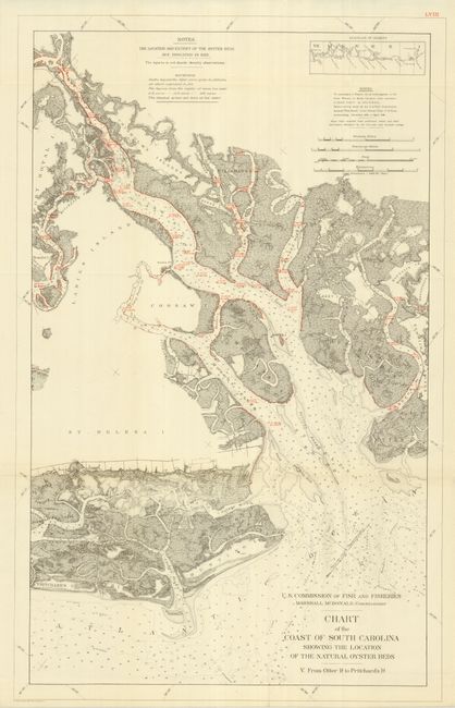
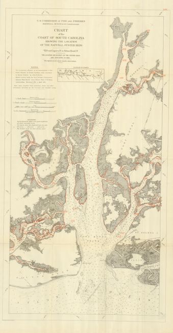
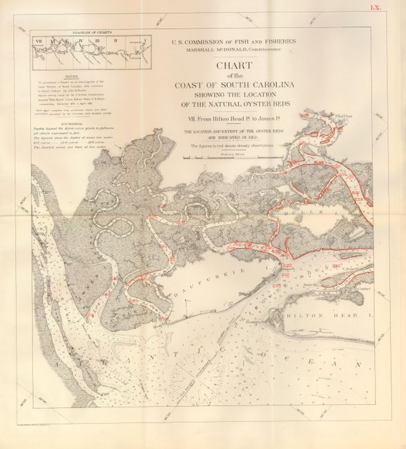
"[Lot of 3] Chart of the Coast of South Carolina Showing the Location of the Natural Oyster Beds V. From Otter Id. to Pritchard's Id. [and] VI. Capers Id. to Hilton Head Id. [and] VII. From Hilton Head Id. to Jones Id.",

Subject: South Carolina

Period: 1891 (dated)

Publication: Bulletin of the United States Fish Commission, Vol. X for 1890

Color: Printed Color

Size:
See Description
Download High Resolution Image
(or just click on image to launch the Zoom viewer)

These charts describe the extent of oyster beds as surveyed by the Fish Commission steamer "Fish Hawk" from December 1890 to April 1891. Each base chart is from the U.S. Coast and Geodetic survey with the addition of red overprinting to show the areas surveyed. Adjacent text also in red gives the water density measurements at the bottom and on the surface. This set illustrates much of the southern coastal area of South Carolina, including some of South Carolina’s most expensive real estate (Hilton Head, etc.). The maps locate Turtle Island, Calibogue Sound, Hilton Head Island, Port Royal Sound, St. Phillips Island, Pritchard's Island, Otter Islands, the Broad, Beaufort, Savannah, May, Morgan, Coosaw and Ashepoo Rivers. Shading shows areas exposed at low tide and the 6 ft., 12 ft. and 18 ft. depth curves are shown. Each lithograph shares the full title as given in the first above. The sizes are: 1) 18.8 x 30"; 2) 18 x 34" ; 3) 16 x 17.4"". The first and last map are fine (A+). The second is also fine save for a mechanical tear at one fold intersection (B+).

By the 1870's, many of the country's oyster fields were becoming severely depleted, which led to oyster management efforts in the form of laws and regulations. This informative set of thematic charts is from one of the reports documenting that effort.

References:

Condition:

See description.

Estimate: $200 - $250

Sold for: $160

Closed on 9/23/2009

Archived