Catalog Archive
Auction 129, Lot 330

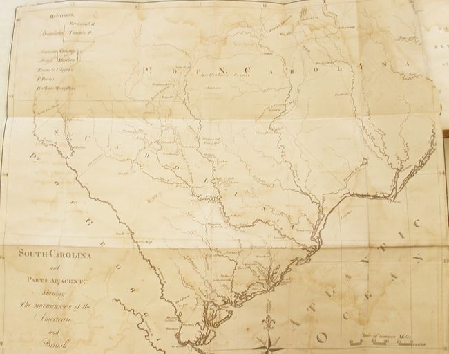
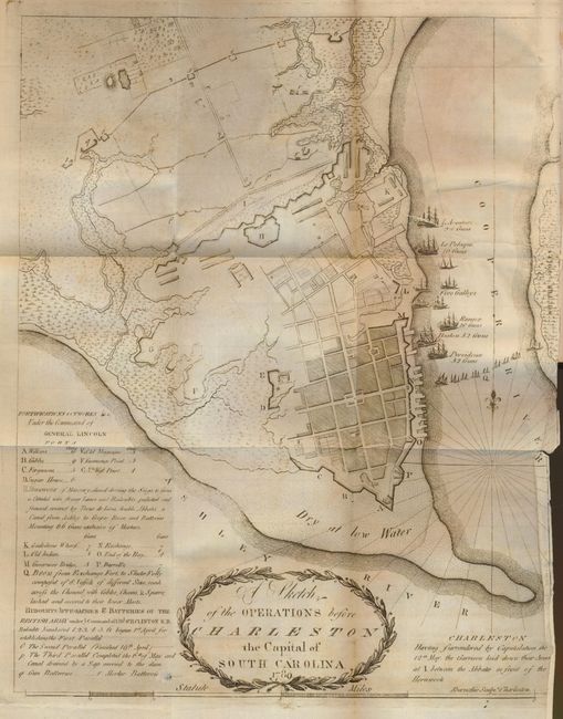
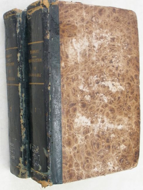
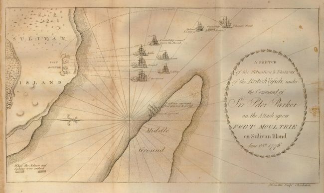
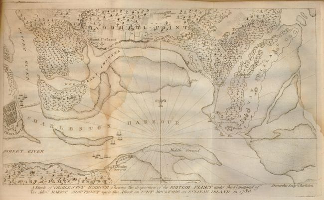
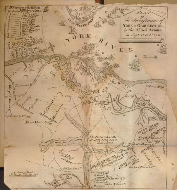
"The History of the Revolution of South Carolina, from a British Province to an Independent State… in Two Volumes",

Subject: South Carolina

Period: 1785 (published)

Publication:

Color: Black & White

Size:
5.3 x 8 inches
13.5 x 20.3 cm
Download High Resolution Image
(or just click on image to launch the Zoom viewer)

This book contains five scarce Revolutionary War period maps. Each map was engraved by the Charleston citizen Abernethie. The maps include the following titles:

1) "South Carolina and Parts Adjacent; Shewing the Movements of the American and British Armies," (22.5 x 19.5")
2) "A Sketch of the Operations before Charleston the Capital of South Carolina 1780" (11.3 x 14.3")
3) "A Sketch of the Situations & Stations of the British Vessels, under the Command of Sir Peter Parker on the Attack upon Fort Moultrie on Sulivan Island June 28th, 1776." (11.5 x 6.5")
4) "A Sketch of Charleston Harbor Shewing the Disposition of the British Fleet under the Command of Vice Adm. Mariot Arbuthnot upon the Attack on Fort Moultrie on Sulivan Island in 1780" (11.5 x 6.5")
5) "Plan of the Investment of York & Gloucester, by the Allied Armies: in Septr. & Octr. 1781." (7.5 x 8.5")

The maps are still bound in the original two volume set of "The History of the Revolution of South-Carolina…" written by David Ramsay, printed by Isaac Collins of Trenton. Ramsay was a resident of Charleston and known for his accurate historical reporting. He is also renowned as the author of "the most objective and sophisticated contemporary account of the Revolution" in his History of the American Revolution. These volumes are an important early history of South Carolina and is notable for being the first work to receive a copyright in the United States. In matching later brown marbled boards with green leather spines and gilt lettered titles. In two volumes: Volume I, xx, 453 pp. plus two large folding engraved maps of Charleston and Fort Moultrie; and Volume II, xx, 574 pp. plus three folding engraved maps of South Carolina, Charleston Harbour, and Yorktown and Gloucester, Virginia. This rare publication is seldom found complete with all five maps.

References: Howes R-36.

Condition: C+

The maps have scattered foxing or toning, a few with small area of damp staining. The large South Carolina map also has some offsetting and a clean opening tear from binding trim. Covers are worn with weak hinges and bindings - new bindings would do wonders for this set. The text of Volume 1 is clean and nice. Volume 2 has a damp stain at edge which affects a small portion of some pages ranging from almost invisible to pronounced with the front and rear portions most affected. Ex-library with call numbers handwritten on lower spines, small bookplates, and embossed stamps on all title and table of contents pages. Letter of deaccession from the Duluth Public Library included.

Estimate: $1,600 - $2,000

Sold for: $2,500

Closed on 9/23/2009

Archived