Catalog Archive
Auction 129, Lot 329

"A Plan of Port Royal Harbour in Carolina With the Proposed Forts, Depth of Water &c. Latitude 32° - 6' North", Moll, Herman

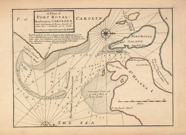
Subject: Hilton Head, South Carolina

Period: 1735 (circa)

Publication: Atlas Minor

Color: Hand Color

Size:
10.5 x 7.8 inches
26.7 x 19.8 cm
Download High Resolution Image
(or just click on image to launch the Zoom viewer)

With numerous soundings and anchorages in the harbor, the map also shows the proposed fort on St. Helena Island, Hilton Head, and Bauford Town on Port Royal Island. A note below the title explains that the harbor is safe and provides access to "ye best Country in Carolina." Off-shore from Hilton Head is Uncertain-Ground with a large area of sea-bed that is "All Dry at Low-water." East of Elizabeth is the location of another proposed fort, most likely the future Fort Fremont. Simple title block, rhumb lines and two compass roses.

References: Cumming (SE) #200; Phillips (A) #574-48.

Condition: A

Dark, early impression. With original margins, with a small chip out of edge at lower right.

Estimate: $350 - $400

Unsold

Closed on 9/23/2009

Archived