Catalog Archive
Auction 129, Lot 285

"A Map of the Seat of the Late War at Boston in the State of Massachusetts",

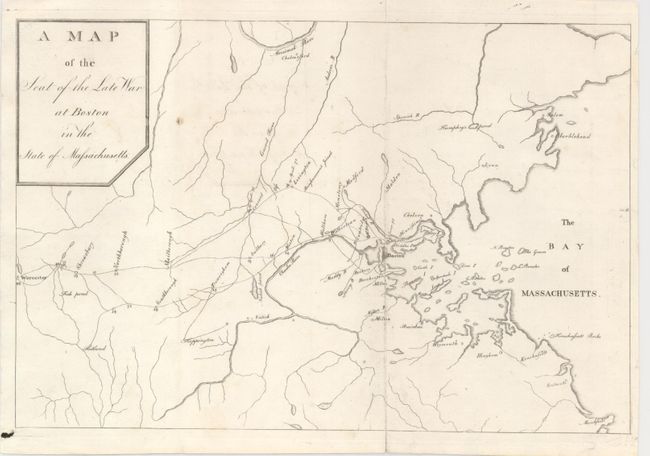
Subject: Boston, Massachusetts

Period: 1789 (published)

Publication: The Columbian Magazine

Color: Black & White

Size:
10.2 x 6.8 inches
25.9 x 17.3 cm
Download High Resolution Image
(or just click on image to launch the Zoom viewer)

This rare map was published in the July 1789 edition of The Columbian Magazine from Philadelphia. It was most likely engraved by J. Trenchard but the map carries no imprint or credit to the engraver. The delicately engraved map has Boston at its center, extending west to Worchester, north to above Salem and Marblehead, and south as far as Marshfield. The map is a simple design with information limited to watershed, roads, towns and villages. The roads feature the mileage between points. We find no prior sales for this rare issue. A copy is held in the LOC.

The Columbian Magazine, published between 1786 and 1792, was a monthly periodical published by a group that included Mathew Carey and Francis Hopkinson. In 1790 the magazine format was altered and the name changed to The Universal Asylum and Columbian Magazine, with Benjamin Rush as the leading contributor. Rush was a signatory of the Declaration of Independence, a social activist, and a leading abolitionist.

References: Phillips (M) p.152.

Condition: A

Clean example with one tiny spot. Issued folding but now flattened.

Estimate: $350 - $450

Sold for: $190

Closed on 9/23/2009

Archived