Catalog Archive
Auction 129, Lot 284

"Carte de l'Ile de Martha's Vineyard avec ses dependances…", Tardieu, Pierre Francois

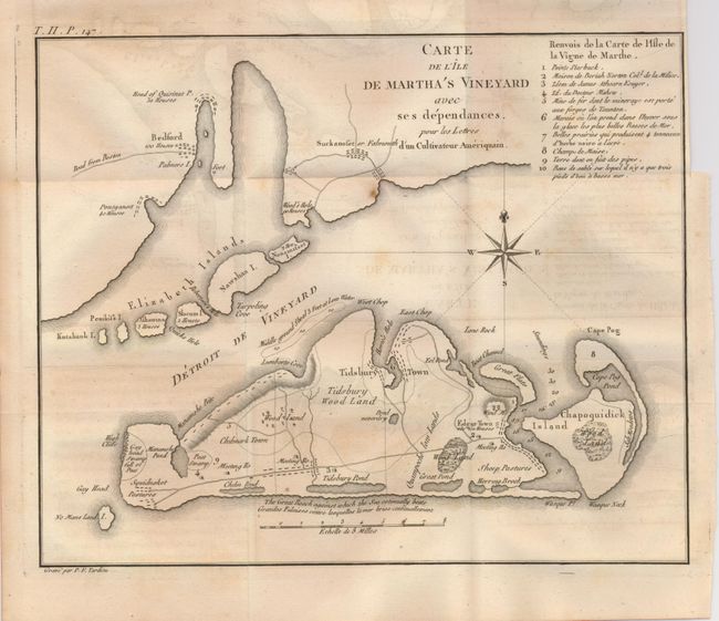
Subject: Massachusetts

Period: 1787 (published)

Publication: Lettres d'un Cultivateur Ameriqain

Color: Black & White

Size:
10.3 x 8.3 inches
26.2 x 21.1 cm
Download High Resolution Image
(or just click on image to launch the Zoom viewer)

This is a rare copper engraved map covering Martha’s Vineyard, the Elizabeth Islands and a portion of Cape Cod. On the Vineyard details include roads, natural features, towns and villages, two meeting houses, etc. Also locates Tidsbury Wood Land south of Tidsbury Town, Eel Pond, Peat Swamp, Squidnoket Pastures, and Cape Pog Pond. The legend at upper right identifies ten features on the map with more information. This map is from the French edition of Letters from an American Farmer, first issued in London in 1783. Howes says it is "Description of American life of great influence in attracting European immigration in the post-revolutionary period. As literature unexcelled by any American work of the eighteenth century." A most desirable and early map of Martha's Vineyard.

References: Phillips (M) p. 389; Howes No. C883

Condition: B+

Folding as issued. Dark impression on thick hand laid paper with wide margins. Some light and diffuse foxing. Some very light offsetting that easily erases.

Estimate: $1,400 - $1,600

Sold for: $1,200

Closed on 9/23/2009

Archived