Catalog Archive
Auction 129, Lot 254

"Soil Map Napa Area California", U.S. Government

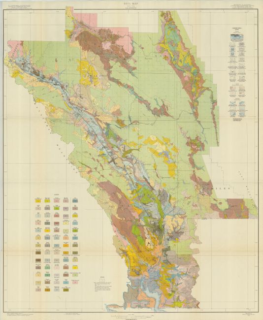
Subject: Napa, California

Period: 1933 (dated)

Publication:

Color: Printed Color

Size:
32 x 38.3 inches
81.3 x 97.3 cm
Download High Resolution Image
(or just click on image to launch the Zoom viewer)

This large folding map shows the famous Napa Valley in amazing detail on a scale of one inch per mile. Beautifully colored and finely engraved, the map locates all towns, villages, roads, railroads, and even individual buildings. This post-Prohibition, Depression-era map extends from Calistoga south to Napa. It locates Stags Leap Manor, Zinfandel, Oak Knoll, Rutherford, Myrtledale Hot Springs, the Pacific Union College and much more. Over sixty different geological types are identified with different colors and patterns, more than we have ever seen on a map. The extensive legend locates numerous physical features. Individual streets in the towns are shown but not named. Lot includes the 76-page disbound report "Soil Survey of the Napa Area, California".

References:

Condition: A+

Map is folding as issued. Bright color and no flaws. Booklet is also fine.

Estimate: $180 - $220

Sold for: $275

Closed on 9/23/2009

Archived