Catalog Archive
Auction 129, Lot 238

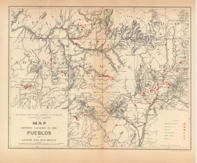
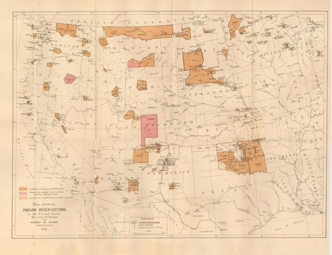
"[Lot of 2] Map Showing the Location of the Pueblos of Arizona and New Mexico [and] Map Showing Indian Reservations in the United States West of the 84th Meridian and Number of Indians Belonging thereto 1881",

Subject: Southwestern United States

Period: 1881 (dated)

Publication:

Color: Printed Color

Size:
See Description
Download High Resolution Image
(or just click on image to launch the Zoom viewer)

1) Map Showing the Location of the Pueblos of Arizona and New Mexico, John Wesley Powell, Smithsonian Institution, 1881, (12 x 9.3"). This is a finely engraved map detailing the various pueblos and Hopi mesas in the region. Within the Hopi area the map locates the mesa villages of Oraibi, Songapovi, Tewa and Walpi in the Province of Tusayan. The map extends east to include Taos and Fort Garland. Locates Mesa Verde, Acoma, Laguna, Fort Defiance, Zuni, Isleta, San Ildefonso, Santa Clara and more. Red overprinted icons indicate Inhabited, Abandoned, and Ruined Pueblos, plus Cavate Lodges, Cliff Lodges, and Towers. It also locates roads, trails, springs, railroads, topography and ruins. All editions we've previously seen of this map have a small engraving of Walpi within the title cartouche, which this uncommon example is lacking. Toned at centerfold otherwise flawless.

2) Map Showing Indian Reservations in the United States West of the 84th Meridian and Number of Indians Belonging thereto 1881, U.S. Government, 1881, (18 x 13"). This is a precisely engraved map that shows existing, proposed and "extinguished" Indian lands via various color and line. This map also shows Indian agencies, Army outposts, towns, railroads and Yellowstone National Park. Very nice, near fine example less hint of color offsetting in lower margin and short binding side trim tear, well closed.

References:

Condition: B+

See individual descriptions.

Estimate: $150 - $200

Sold for: $100

Closed on 9/23/2009

Archived