Catalog Archive
Auction 129, Lot 169

"[Louisiana and British Colonies in North America]", Gibson, John

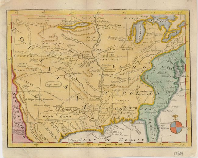
Subject: Colonial United States

Period: 1763 (published)

Publication: Gentleman's Magazine

Color: Hand Color

Size:
9.5 x 7 inches
24.1 x 17.8 cm
Download High Resolution Image
(or just click on image to launch the Zoom viewer)

Fascinating little map of the future United States, extending west to the Rocky Mountains. The map illustrates the conflicting British and French claims that resulted in the French & Indian War. The map's labeling represents the British claim, with the Carolinas, Georgia and Virginia extending to the Mississippi River, but the coloring reflects the French claims to the region west of the Appalachian and Allegheny Mountains. Fascinating details include the locations of Indian tribes and villages, gold mines, forts and frontier outposts. Large expanses of country are shown belonging to various Indian nations. In present day Texas Country of the Cenis, Gr. Village of the Cenis, and the Garrison of the North or of St. John Baptist are noted. A large river and lake west of the Mississippi is identified as The Great River according to M. de la Hontan.

References: Jolly GENT-169; Sellers & Van Ee #109.

Condition: B+

Issued folded, now flattened and backed with Japanese tissue with later color.

Estimate: $250 - $300

Sold for: $180

Closed on 9/23/2009

Archived