Catalog Archive
Auction 129, Lot 147

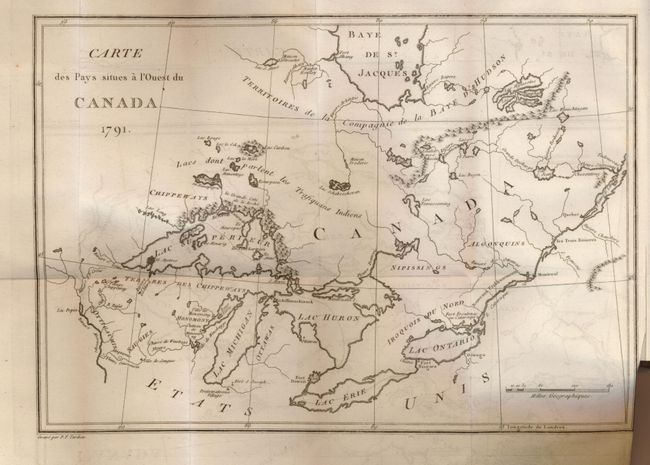
"Voyages chez Differentes Nations Sauvages de l'Amerique Septentrionale [with] Carte des Pays Situes a l'Ouest du Canada 1791", Long, John

Subject: Canada & United States

Period: 1794 (published)

Publication:

Color: Black & White

Size:
See Description
Download High Resolution Image
(or just click on image to launch the Zoom viewer)

This map (11.8 x 8.3") is centered on the Great Lakes and covers the region form Hudson Bay to the upper Mississippi River and the mouth of the St. Laurence River. It provides information on Indian villages and forts. The map is bound in the French edition of John Long's journal, which describes the manners and customs of the North American Indians. First French edition, with a 20-page introduction by the French translator, as well as notes and additions to the original text, published in 1794. Bound in original, paper covered boards with leather, gold embossed, spine.

John Long came to Canada in 1768, worked in Montreal and on the Caughnawaga mission. He traveled and traded throughout the Upper Country and the territory of the Hudson Bay Company and fought with the pro-British Indians in the American Revolutionary War. His journal is a graphic record of Indian life and customs and of the conditions in the fur trade.

References: Howes L443.

Condition: A

The map is folded with normal binding trim and some minor offsetting that erases easily. The binding is worn with some splits on spine, but still tight. Contents complete and clean.

Estimate: $550 - $750

Sold for: $350

Closed on 9/23/2009

Archived