Catalog Archive
Auction 129, Lot 127

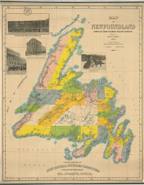
"Map of Newfoundland Compiled from the Most Recent Surveys Drawn by Geo. E. Turner",

Subject: Canada

Period: 1925 (dated)

Publication:

Color: Printed Color

Size:
29.3 x 36 inches
74.4 x 91.4 cm
Download High Resolution Image
(or just click on image to launch the Zoom viewer)

This wall map contains a remarkable amount of information with hundreds of place names along the coastlines. Each electoral district is colored and named, but two large areas in the interior are unorganized and unnamed. It locates rivers, lakes, fjords, topography with many mountains named, as well as many settlements. The map was "Published by permission of the Government of Newfoundland." With four photo illustrations, three are advertisements for the Royal Stores, Limited, and the last one shows two huge Newfoundland dogs. On thick paper with original green metal clamping bands at top and bottom. Blank verso. A most uncommon issue in remarkable condition for a map of this type and size.

References:

Condition: A

A couple spots near top and a little light soiling also mostly at top.

Estimate: $250 - $300

Sold for: $150

Closed on 9/23/2009

Archived