Catalog Archive
Auction 129, Lot 124

"A Chart of Part of the Coast of Labradore, from the Straights of Bell Isle, to Cape Bluff", Jefferys, Thomas
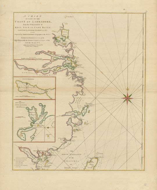
Subject: Canada

Period: 1770 (dated)

Publication: The North American Pilot

Color: Hand Color

Size:
18 x 21.5 inches
45.7 x 54.6 cm
Download High Resolution Image
(or just click on image to launch the Zoom viewer)

This handsome chart shows the Labrador coast from Cape Bluff south to the North Entrance of the Straights of Bell Isle. It depicts numerous harbors, bays and inlets with soundings and navigational hazards along the coastline. Two inset charts in lower left show Petty Harbour and the three harbors of Sophia, Charlotte and Mecklenburg. A large compass rose and rhumb lines orient the chart. This coastline was surveyed by Joseph Gilbert in 1767. Published by Sayer and Bennett.

References: Sellers & Van Ee #685.

Condition: B

There is a large, professional paper restoration at upper left with the border and one letter in the title replaced in neat facsimile. There are old paper repairs on the fold, in the blank margins.

Estimate: $200 - $250

Sold for: $150

Closed on 9/23/2009

Archived