Catalog Archive
Auction 129, Lot 117

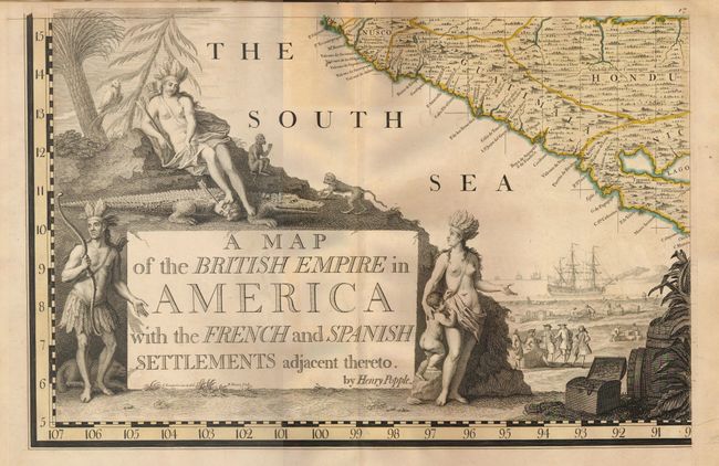
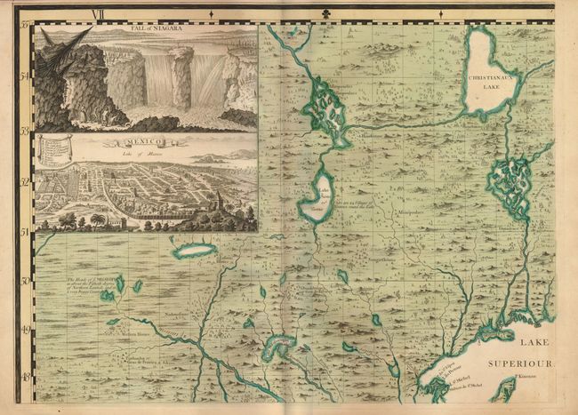
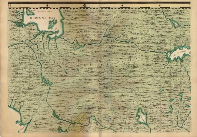
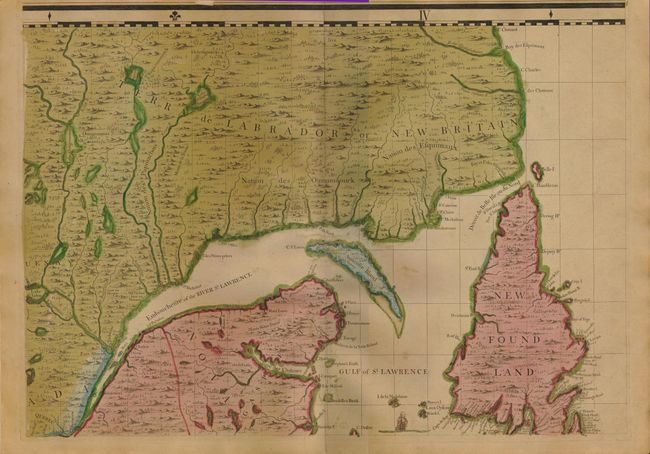
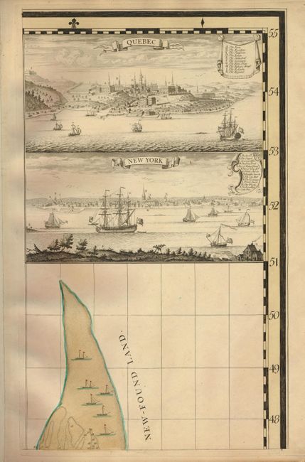
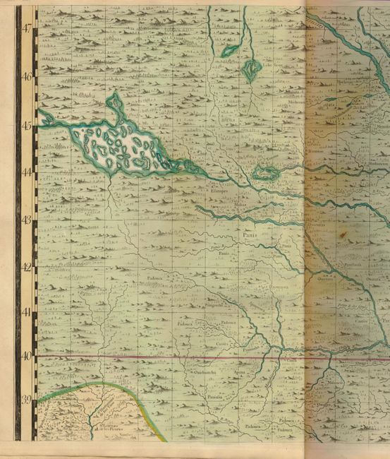
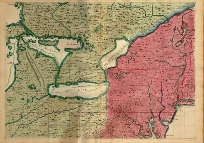
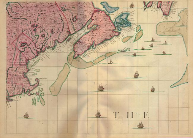
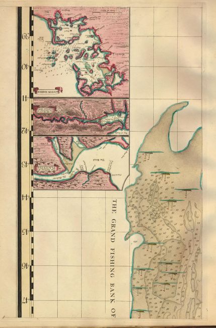
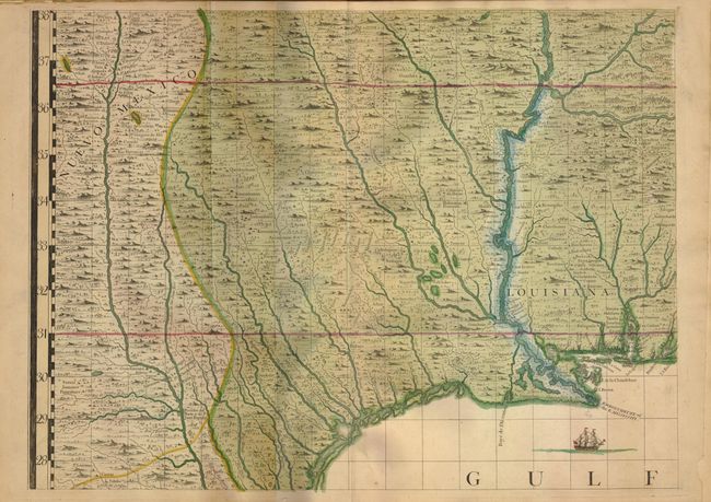
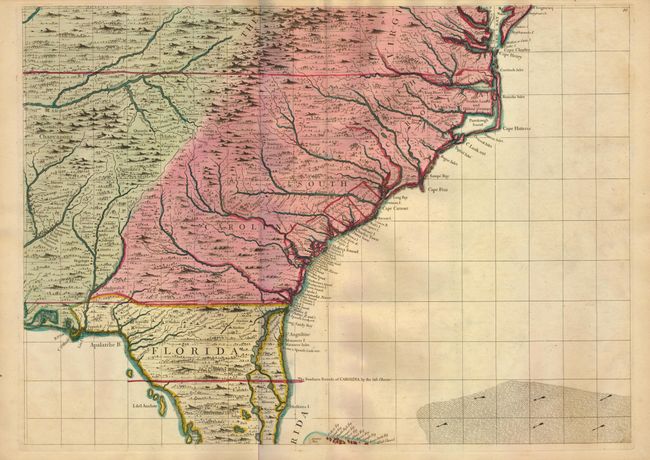
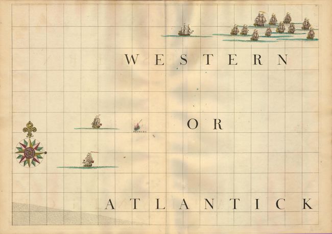
"A Map of the British Empire in America with the French and Spanish Settlements Adjacent Thereto", Popple, Henry

Subject: Colonial North America and West Indies

Period: 1734 (circa)

Publication:

Color: Hand Color

Size:
See Description
Download High Resolution Image
(or just click on image to launch the Zoom viewer)

This is one of the most important colonial maps of North America. Bound in the original atlas format with marbled paper covers, this extremely rare, large-scale map is printed on 20 folio sheets. The map covers the eastern part of North America from Hudson Bay, through the Caribbean, to the northern coast of South America. Each sheet is beautifully engraved, intensively detailed and adorned with fleets of ships, several vignettes, and inset plans. The richly embellished title cartouche features Native Americans and colonial merchants representing the wealth of the region. This is the fifth state according to Pritchard & Taliaferro (6th according to Babinski). The sheets (15 double-page & five single-page) are numbered in the upper right corner. Included is state 1 of "The Contents of each Sheet of the Twenty Plates of Mr. Popple's Map of America," which is a loose leaf ( 8 x 10") inserted in the atlas. The key map is NOT present, and does not appear to have been included. If the sheets were assembled the map would measure approximately 95 x 100".

The map is in full original color with green distinguishing Indian lands, red for British possessions, yellow for Spanish colonies, blue for French claims, and purple for the Dutch. The political use of color is very evident with blue sparingly used and limited to a narrow strip along the Mississippi River, the north bank of the St. Lawrence River, St. John's Island, Cape Breton Islands and Anticoste Island on the continent, and a few islands in the West Indies. The coloring also illuminates some disputed boundaries such as a red (British) line drawn across the northern part of Florida placing the southern boundary of South Carolina well into Spanish territory, and a British colony shown on the Bay of Campeche noted as Logwood Creeks, which in reality had been controlled by the Spanish since 1722.

The need for a comprehensive map of the British possessions in North America and the West Indies became more apparent as tensions grew between the colonial powers in the early part of the eighteenth century. The Board of Trade and Plantations, for which three generations of the Popple family had served, encouraged the production of a map to delineate the interior of the continent and substantiate British territorial claims. The compilation and production of the map required a remarkable about of preparation. Popple gathered the information from a variety of sources including previously published and manuscript maps, as well as firsthand information from the Board of Trade and Plantations and colonial settlers. The map was designed by Clement Lempriere and engraved by William Henry Toms, Bernard Baron and Richard William Seale. It was initially published by Popple in 1733 at an extremely high price (4 Guineas) and did not gain popularity until the outbreak of the War of Jenkins' Ear in 1739, when it was republished by Toms and Harding at a greatly reduced price. The map became immensely influential throughout Europe and America and was copied by several cartographers in smaller format. George Washington, Benjamin Franklin, and John Adams were among the important revolutionary leaders who owned Popple's map. Today, institutions own most of the surviving examples and it rarely appears on the market. It is truly a significant piece of Americana and a quintessential centerpiece of any serious collection of North American maps.

References: Babinski (http://usm.maine.edu/maps/popple); Cumming (SE) #216; Pritchard & Taliaferro pp 134-141.

Condition: B+

Overall very good with minimal toning on a few sheets. There is some minor worming on the upper fold from Sheet 13 to Sheet 20 (most visible on Sheet 19). The covers are worn with the front cover separated. Sheet 1 is disbound and Sheet 3 is split 4" on the upper fold.

Estimate: $70,000 - $90,000

Sold for: $52,500

Closed on 9/23/2009

Archived