"West Indies. Jamaica", British Admiralty
Subject: Jamaica
Period: 1880 (dated)
Publication:
Color: Black & White
Size:
39 x 24.5 inches
99.1 x 62.2 cm
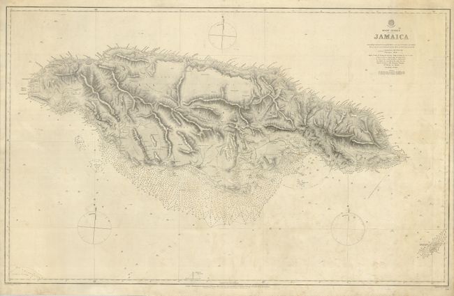
This remarkably detailed chart is from the surveys of Staff Comr. G. Stanley and Lieut. G.F. Pullen on H.M.S. Sparrowhawk in 1880. The chart was issued unfolded and is mounted on heavy paper. There is fine detail of shoals, rocks, cays, bottom, soundings, etc. The topography, watershed, towns and villages of the island are fully mapped. Hand colored yellow and red highlights locate lighthouses. Three compass roses show magnetic variation with fleur-de-lis. At lower right is Morant Cay.
References:
Condition: B+
Overall light soiling. The map is mounted on heavy paper, as issued.