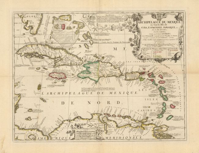
"Archipelague du Mexique, ou Sont les Isles de Cuba, Espagnole, I'Amaique, etc. Avec les Isles Lucayes, et les Isles Caribes, Connues sous le Nom d'Antilles", Coronelli/Nolin
Subject: Caribbean
Period: 1742 (dated)
Publication:
Color: Hand Color
Size:
23.2 x 17.5 inches
58.9 x 44.5 cm
This splendid and uncommon map covers all the West Indies, including the Bahamas and the southern tip of Florida. The partnership of Coronelli and Nolin produced some of the best regional maps of the Americas of the period. The map provides an excellent view of the islands, banks and shoals. The large decorative title cartouche incorporates an extensive key. It is surrounded with fruits, natives, and animals of the islands, including a sea turtle and a flying fish. An elegantly-wrought passionflower vine surrounds the explanation at top, while ginger and indigo adorn the scale of miles at bottom.
References:
Condition: A
Sharp impression and original outline color with wide margins. Some extraneous folds, reinforced with light Japanese tissue, hinge remnants, and a private library stamp on verso.