Catalog Archive
Auction 128, Lot 414

"General Plan of the Canal Indicating the Project with Dividing Bed at 68 ft. Level", Bien, Julius

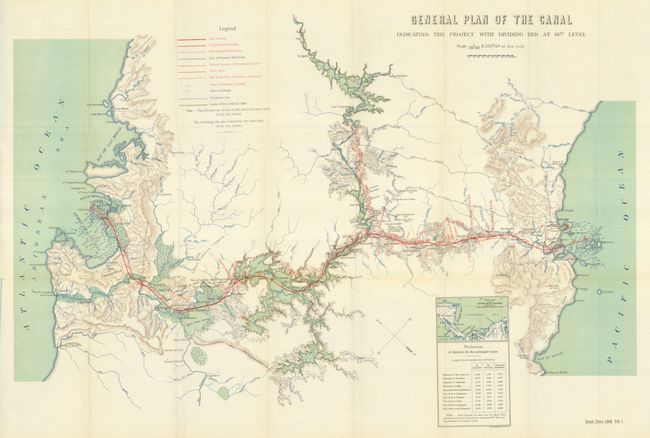
Subject: Panama Canal Project

Period: 1900 (published)

Publication: Sen. Doc. 188, 1st Sess., 56th Cong.

Color: Printed Color

Size:
32 x 19 inches
81.3 x 48.3 cm
Download High Resolution Image
(or just click on image to launch the Zoom viewer)

This map has beautiful color and precise engraving. Fine detail illustrates the proposed route of the Panama Canal and as far north as El Aguila on the Rio Chagres. Locates the villages of San Juan, Santa Barbara, Dos Bocas, El Vigia, Las Campanas, Alhajuela, Garun, and many more. Extensive legend identifies the line of the canal, completed and uncompleted diversions, Panama Rail Road, limits of the artificial lake and more. A small inset portrays a "General chart of the Isthmus of Panama Indicating the Position of the Canal" and a table lists the distance reduced via the canal to various ports including San Francisco, Honolulu, Valparaiso, Victoria (Canada) from the "official tables published by the French Government…January 29th, 1881." This uncommon map will be a fine addition to any Panama Canal collection.

References:

Condition: A+

Folding as issued. A flawless, perfect example.

Estimate: $160 - $200

Sold for: $170

Closed on 5/20/2009

Archived