Catalog Archive
Auction 128, Lot 338

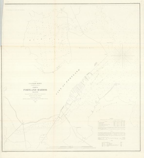
"Chart of Portland Harbor Maine", U.S. Coast Survey
Subject: Maine, Portland

Period: 1855 (dated)

Publication:

Color: Black & White

Size:
20.5 x 21.8 inches
52.1 x 55.4 cm
Download High Resolution Image
(or just click on image to launch the Zoom viewer)

The title continues "Showing the Wharf Line recommended by the Commissioners appointed by the City Authorities." This early harbor chart of Portland was produced by the Coast Survey under the command of Lieut. T.A. Craven, assisted by Lieut. M. Woodhull. It is a close detail of the wharf area that extends to show the Back Cove, Cape Elizabeth, and Turner's Island. Locates the city without street detail, the Portland Bridge, ship yard, Ft. Prebles, Fish Point, Pomroy's Rock, the Cumberland & Oxford Canal, and names several wharfs. Notations provide guidance for mariners on currents, tides, and soundings. Drawn by A. Balbach and engraved by W. Ogilvie and his apprentice F.W. Benner.

References:

Condition: B+

The map image is fine on bright, clean paper, but there are a few fold splits that will benefit from backing the map.

Estimate: $95 - $120

Unsold

Closed on 5/20/2009

Archived