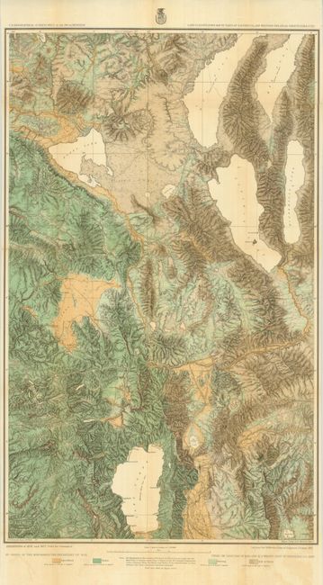
"Land Classification Map of Parts of Eastern Cal. And Western Nev., Atlas Sheets 47(B) & 47(D)", Wheeler, George (Lt)
Subject: Western United States
Period: 1879 (published)
Publication: U.S. Geographical Surveys West of the 100th Meridian
Color: Printed Color
Size:
19 x 31 inches
48.3 x 78.7 cm
This map is from Wheeler's series of maps showing land classification by Agriculture, Timber, and Grazing, as well as Arid or Barren with vivid color. From the 1877 survey, this large map locates Reno, Carson, and Virginia City. Covers portions of the drainage basins of the Feather, Yuba, American, Truckee and Carson Rivers; Tahoe, Pyramid, Winnemucca and Honey Lakes and the so-called Mud Lakes; also the country in the vicinity of the Comstock Lode and that portion of the Sierra Nevada through which the Central Pacific Railroad passes. Finely colored in green and ochre with varying line. Dated 1877 but published by Wheeler in 1879.
References:
Condition: B+
Folding, as issued, on thick paper with fine color and impression. The map has some light offsetting from the strong color and very light fold toning visible in Pyramid Lake. A couple fold intersection folds have small tape repairs on verso.