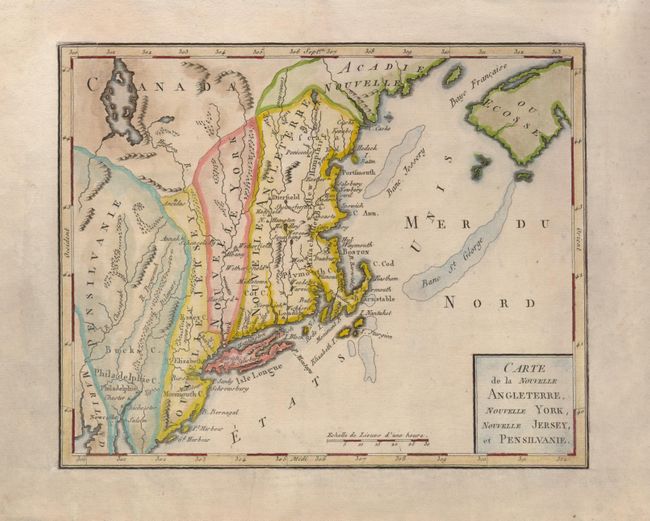
"Carte de la Nouvelle Angleterre, Nouvelle York, Nouvelle Jersey, et Pensilvanie", Bertholon, C.
Subject: New England and Mid-Atlantic
Period: 1799 (circa)
Publication: Atlas Moderne Portatif…
Color: Hand Color
Size:
8.5 x 6.8 inches
21.6 x 17.3 cm
This interesting map of New England exhibits some very odd boundaries. The states appear as amorphous strips stretching north-south displaying the lack of French knowledge of the existing boundaries. In New England, Massachusetts Bay and New Hampshire seem to have been added to the plate, and are spelled Massachusset Bey and Hew Hampshire. The map is a close copy of Joseph La Porte's 1780 map of the same title, with a simplified cartouche and the change of Possessions Angloises in the Atlantic to Etats Unis reflecting the French support for American independence.
References: cf McCorkle #780.2.
Condition: B+
The map has been trimmed to the neatline and mounted on a sheet of early 19th century paper for inclusion in a composite atlas. There is some minor uneven toning in the map.