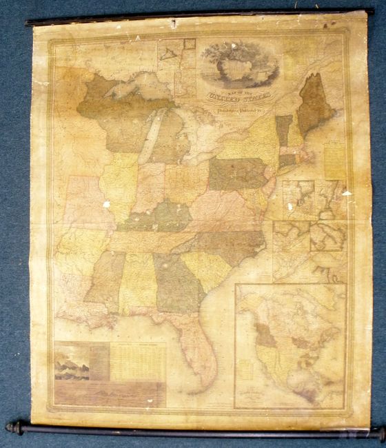
"Map of the United States by J.H. Young", Mitchell, Samuel Augustus
Subject: Eastern United States
Period: 1831 (dated)
Publication:
Color: Hand Color
Size:
34.5 x 43 inches
87.6 x 109.2 cm
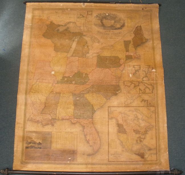
This is the rare first edition of the first wall map issued by Mitchell. The title continues "Philadelphia: S. Augustus Mitchell. Entered According to Act of Congress...October 10th, 1831 by S. Augustus Mitchell." The map was "Engraved by J.H. Young, D. Haines, and F. Dankworth." Rumsey notes that the first edition does not have the counties delineated and numbered, as incorrectly stated by Ristow. The first edition shows more of the western territory than later editions by eliminating the index of counties. This map is Mitchell and Young’s first "original" publication as it predates the Traveler's Guide by one year, although they were both likely published in 1832. Mitchell had previously updated and reissued Finley’s American Atlas and Pocket Maps, but this map remains his inaugural cartographic creation.
The map extends west to Missouri and Arkansas Territory, or to about today’s 95th meridian, but the map uses only "Longitude West from Washington." Michigan is a territory and the huge area west of Lake Michigan later known as Western Territory is here simply labeled "Attached to Michigan." Remarkable detail throughout with a large number of early towns, villages and wagon roads noted. Of special interest are the individual mileages given on every road between every junction, an astounding accomplishment. The entire map is surrounded by a decorative border.
With three tables: "Statistics of the United States" shows population to 1830 including whites, free blacks, and slaves; "Distances on the Erie and Champlain Canals"; and "Lengths of the Principle Canals in the United States." The two thematic charts are "Comparative Lengths of the Principle Rivers of the United States" and "Comparative Heights of the Principle Mountains and Hills in the United States." Plus six city plans: Boston; New York, Philadelphia; Baltimore & Washington; Vicinity of Charleston; and Vicinity of N. Orleans.
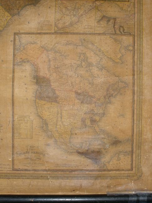
The large inset map of North America includes "all the Recent Geographical Discoveries." This map shows a huge Missouri Territory, and the border in the northwest extends well into today’s British Columbia suggesting the Fifty-Four Forty or Fight boundary dispute between the United States and Great Britain. Shows a large Indian Territory, names Texas and shows the large Great Desert extending north from the panhandle.
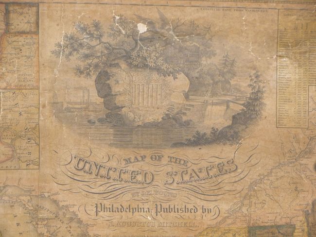
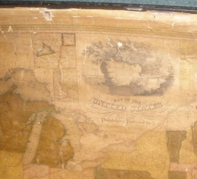
The cartouche is a tour-de-force for which Ristow devotes a paragraph describing the United States shield on a rock from which grows a tree with a large eagle. Around the tree is a harbor scene with steam and sailing ships and an early rendering of a steam locomotive: all modes of transportation that made western expansion possible. Fancy lettering and flourishes complete the cartouche.
This is one of the earliest steel-engraved maps created in the United States, a process favored by James H. Young. The commercial success of this map propelled his business to a position of dominance in American map making. It also signaled the beginning of the long alliance between Mitchell and the brilliant engraver Young, whose aesthetic sense and precision are beautifully showcased here. Mitchell and Young began making maps at the start of grand national expansion, following the expeditions of Lewis and Clark, Pike, and others; their path finding stimulated an interest in the West and thus created a strong market for maps and guidebooks.
References: Karrow #1-1473; Ristow p. 309; Rumsey #2723.
Condition: C
The map is complete and generally sound with both top and bottom wooden rollers. The lower roller is barely attached. The varnish is darkened, but the map does not suffer from water stains as normally seen. There are six small areas of paper missing that will require facsimile work, the largest is about 1" x 3/8" the worst are two in the eagle. Also a hole in the upper margin in a blank area well above the neatline. A fairly straightforward restoration will present the new owner with a fabulous example of this American rarity.