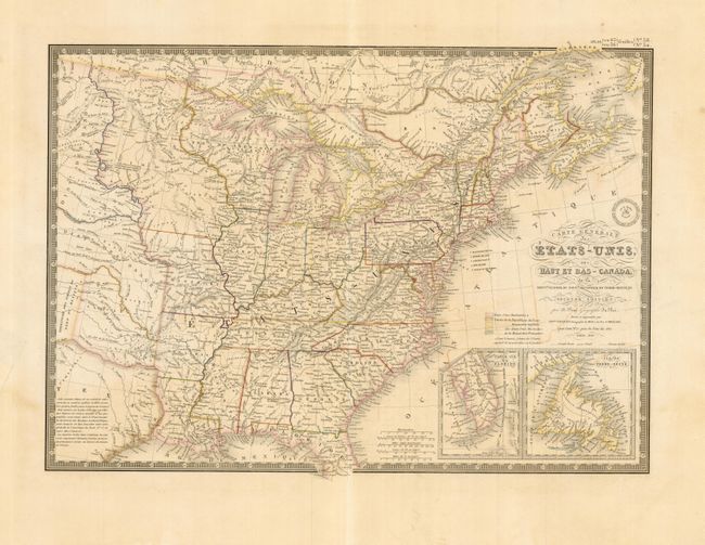
"Carte Generale des Etats-Unis, des Haut et Bas-Canada…", Brue, Adrien Hubert
Subject: Eastern United States & Canada
Period: 1843 (dated)
Publication:
Color: Hand Color
Size:
20.2 x 14.2 inches
51.3 x 36.1 cm
This finely engraved map covers all the eastern United States to about the 100th Meridian, with a bit of southern Canada. The western territories include the North West Territory encompassing present day Wisconsin and Minnesota, a very large Iowa Territory taking in all the area north of Missouri and over to the Missouri River, Missouri is also oversized, covering part of present day Kansas up to the Missouri River. The rest of the west is designated as Indian Districts. The eastern part of Texas is shown, and is designated as an Independent Republic. There are insets of the tip of Florida and Newfoundland. This is the second edition, the first edition to show Texas as a Republic.
References:
Condition: B+
Original outline color with slight offsetting visible in blank ocean. There are a couple minor tears in the bottom margin, well away from the map, and marginal centerfold split just reaches lower border.