Catalog Archive
Auction 128, Lot 168

"The British Governments in Nth. America laid down agreeable to the Proclamation of Octr. 7, 1763", Gibson, John

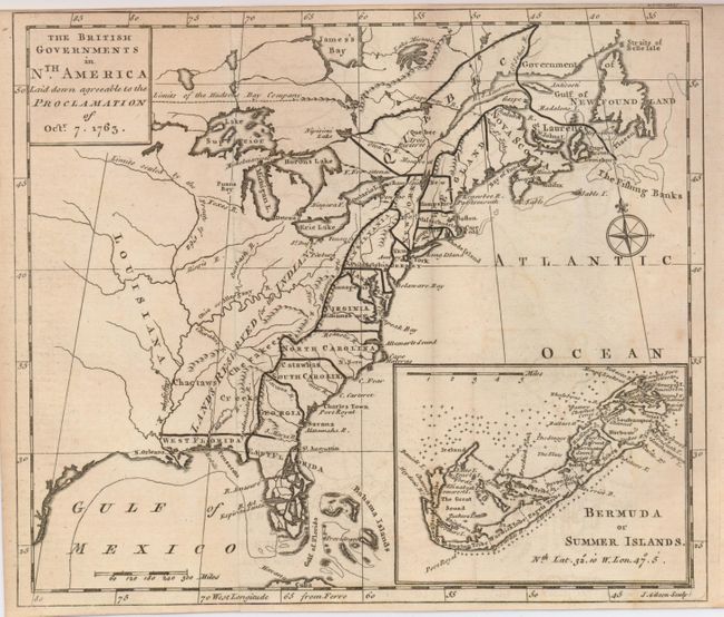
Subject: Colonial United States and Canada

Period: 1763 (dated)

Publication: Gentleman's Magazine

Color: Black & White

Size:
9.3 x 8 inches
23.6 x 20.3 cm
Download High Resolution Image
(or just click on image to launch the Zoom viewer)

This great map was designed to illustrate the new boundaries established at the end of the French and Indian War when England came into possession of the former French and Spanish settlements in Canada and Florida. It covers the east coast from Newfoundland down the coast to east and west Florida, the Bahamas, inland including the Great Lakes and French Louisiana. The large "Lands reserved for the Indians" lies west of the Appalachians. Each colony is shown with a wide engraved line. Large inset illustrates "Bermuda or Summer Islands." Compass rose with the fleur-de-lis decorate the strong engraving. Issued in the December 1763 issue of Gentleman's Magazine.

References: Jolly GENT-170; Fite & Freeman #55, p. 218-221; McCorkle #763.3; Sellers & Van Ee #110.

Condition: B+

Fine impression on thick hand laid paper with original margins, folding as issued. A little light offsetting.

Estimate: $250 - $350

Sold for: $300

Closed on 5/20/2009

Archived