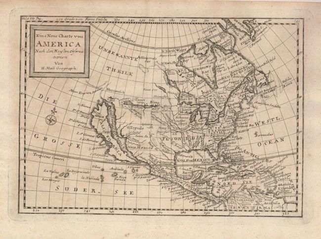
"Eine Neue Charte von America Nach den Neusten Observationen", Moll, Herman
Subject: North America
Period: 1744 (published)
Publication: German edition of "Osborne's A Collection of Voyages & Travels"
Color: Black & White
Size:
9.8 x 7 inches
24.9 x 17.8 cm
This is a German edition of Moll's attractive map of North America that extends to include the West Indies and northern South America. The Island of California dominates the west coast with the Gulf von California, Strait of Anian (Meer Enge von Aninon), Mozeemlek Country and Parts Unknown (Unbekannte Theile) shown above the island. The British Colonies are confined to the eastern seaboard and Florida occupies all of the southern United States. Lake Superior is simply named Obere See (Upper Lake). Lahontan's mythical Longue River stretches between two lakes in the west, with a notation that translates to "Many villages on the islands" in the most western lake. A decorative compass rose fills the Great South Sea (Die Grosse Suder See). The notation at upper left suggests this map was featured adjacent to the title page in Volume I.
References: cf McLaughlin #225.
Condition: B+
On a fine sheet of hand laid paper with original deckle-edged paper. Scattered toning or foxing.