Catalog Archive
Auction 128, Lot 120

"Karte von Nord-America, Zur Geschichte von Neu-Frankreich…", Bellin, Jacques Nicolas

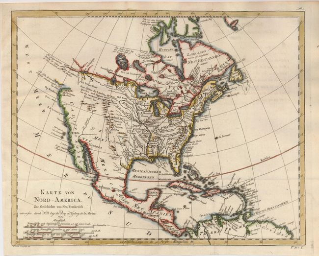
Subject: North America

Period: 1743 (dated)

Publication: Allegmeine Historie der Reisen zu Wasser unde Lande

Color: Hand Color

Size:
13.6 x 11 inches
34.5 x 27.9 cm
Download High Resolution Image
(or just click on image to launch the Zoom viewer)

This is a scarce German edition of Bellin's interesting map of North America that illustrates the travels of Pierre Francois Xavier de Charlevoix, a Jesuit who explored the French colonies in North America in the early part of the eighteenth century. The most distinctive feature of the map is the River of the West shown as a definitive waterway flowing west from Lake Superior to the Pacific Ocean near the Berg von glanzen den Steinen (mountain of brilliant stones). The actual northwest coastline is indistinct with notations of the discoveries of Martin d'Aguilar. The Missouri, Rio Grande (Nord-Fluss), and Colorado Rivers all originate near each other beneath a notation to the effect that reports of the kingdoms of Quivira and Taguiao are uncertain. The Mississippi River system and the Great Lakes reflect Charlevoix's travels in the region and reports he compiled from fur traders.

References:

Condition: A

Issued folded, now flattened with a bit of faint offsetting.

Estimate: $300 - $400

Sold for: $170

Closed on 5/20/2009

Archived