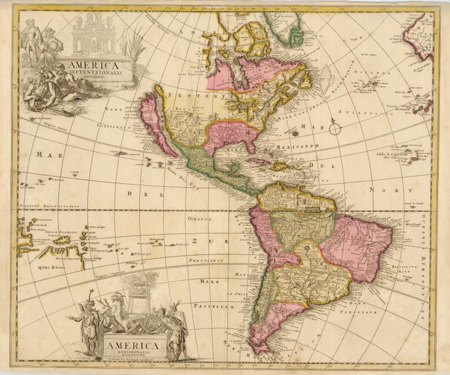
"America Septentrionalis Novissima / America Meridionalis Accuratissima", Schenk, Pieter
Subject: Western Hemisphere
Period: 1695 (circa)
Publication:
Color: Hand Color
Size:
22.3 x 19 inches
56.6 x 48.3 cm
This is an extremely handsome map of the Americas with two large figurative title cartouches representing each of the continents. The cartography of North America is based on the Sanson-Jaillot model with California as an island and the R. del Norte (Rio Grande) flowing westward from a large inland lake located just north of Taos. Buttons Bay and the Great Lakes are both left open-ended in the west, allowing the possibility of a Northwest Passage. In South America the mythical Prime Lacus straddles the equator, the Amazon River is shown as an elaborate network of waterways, and the Paraguay River has it headwaters in the spurious Xarayes Lake. Quiri Regio and Insule Salmonis are prominently featured in the Pacific.
References: McLaughlin #120; Tooley (Amer) p. 125 #56.
Condition: B+
Nice impression and lovely original color with a few light areas of toning and two tiny worm holes in blank regions of the map. The bottom fold has a tiny separation in the blank margin.