Catalog Archive
Auction 127, Lot 80

"L'America Settentrionale e Meridionale Incisa dalla Fratelli Bordiga", Bordiga, F.

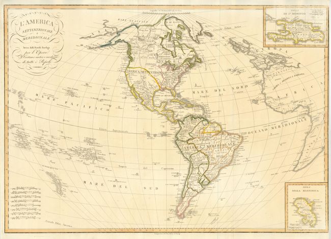
Subject: Western Hemisphere

Period: 1826 (circa)

Publication:

Color: Hand Color

Size:
29 x 20.5 inches
73.7 x 52.1 cm
Download High Resolution Image
(or just click on image to launch the Zoom viewer)

A very scarce Italian produced map that features fine engraved lines and an unusual projection. In North America, Alaska is fairly well formed and labeled Alaska in the western end of the Alaska Peninsula. Spain is in control of the entire Southwest including Texas and up to Luigiana (Louisiana Territory). The U.S. extends only to the Mississippi River. South America is well shown with all political divisions delineated. The map extends to part of Africa and Europe, and all of Great Britain. In the Pacific Ocean the map identifies the Sandwich Islands. Inset at lower right "Isola Della Martinica" and another at upper right "Isola de St. Domingo." The title contains flourishes and some script. Eight distance scales are stacked at lower left.

References:

Condition: B+

Crisp, dark impression and clean, bright paper. Repaired tear into upper right inset, with a small area of light impression in upper and lower right border. Close trimmed at right almost to neatline, apparently as issued.

Estimate: $275 - $350

Unsold

Closed on 2/25/2009

Archived