Catalog Archive
Auction 127, Lot 753

"A New Mapp of Africa Divided into Kingdoms and Provinces", Lea & Overton
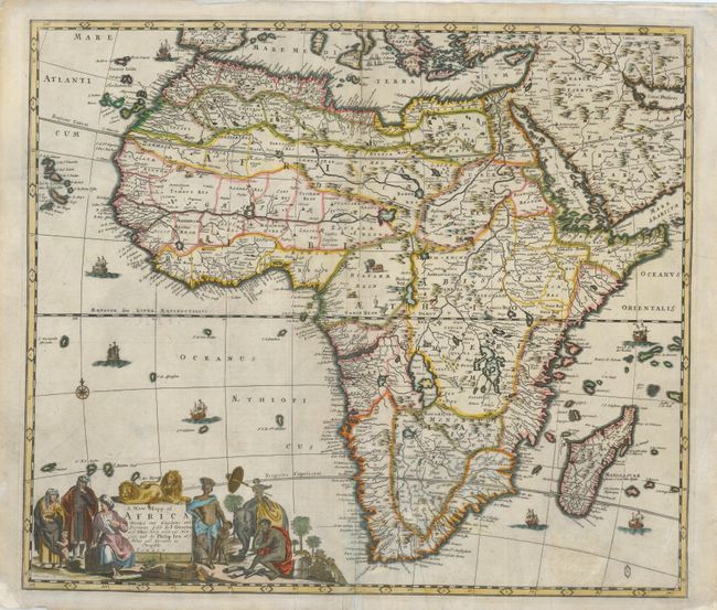
Subject: Africa

Period: 1690 (circa)

Publication: An Atlas Contining ye Best Maps of the Several Parts of the World

Color: Hand Color

Size:
22 x 19 inches
55.9 x 48.3 cm
Download High Resolution Image
(or just click on image to launch the Zoom viewer)

This is an uncommon map of the continent based on the popular map of Frederick de Wit. The Nile appears according to the ancient pattern of Ptolemy, arising from the two lakes of Zaire and Zafflan. The kingdom of Monomotapa extends as far south as the Rio de Infante and there are few names in the interior of the Cape. The fictitious N. I. de Sta. Helena appears in the South Atlantic. The interior is decorated with a variety of indigenous animals and seven small ships sail in the oceans. The title cartouche was also copied from De Wit and features Moors and Africans with a child seated on an elephant and two lions perched atop the cartouche. This is the second state with Philip Lea's address at ye Atlas and Hercules in Cheapside.

References: Betz #141.2; Phillips (A) #4271-3.

Condition: C+

The map has some old, and now very faint, brown ink notations on the verso of the left side and on the map at bottom. Some pastel has been applied over the ink. There are a couple of minor cracks resulting from oxidation of the green outline color. There are several edge tears (some repaired) in the margins, not affecting the map.

Estimate: $750 - $850

Sold for: $600

Closed on 2/25/2009

Archived