Catalog Archive
Auction 127, Lot 74

"Hemisphere Occidental Dresse en 1720 pour l'usage particulier du Roy sur les Observations Astronomiques et Geographiques raportees la meme annee dans l'Histoire et dans les memoires de l'Academie Rle. de Sciences…", Delisle/Buache

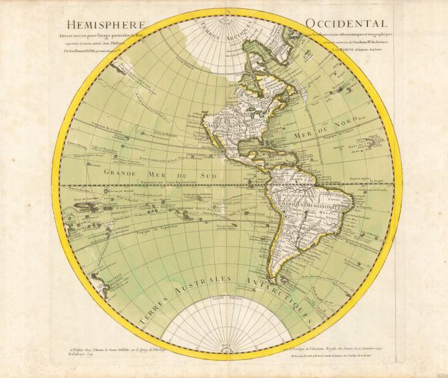
Subject: Western Hemisphere

Period: 1745 (dated)

Publication:

Color: Hand Color

Size:
20 x 20 inches
50.8 x 50.8 cm
Download High Resolution Image
(or just click on image to launch the Zoom viewer)

This fine map of the Western Hemisphere shows various explorers' routes and additionally provides a unique view of the geographic knowledge in the New World in the early part of the 18th century. The northwest coast of North America is completely blank reflecting Delisle's scientific approach to cartography. The French territory of Louisiane takes up the lion's share of North America at the expense of the British colonies. This political bias was due to Delisle's position as geographer to the King of France. The exploration of the Pacific is illustrated with the explorers' tracks up to the year 1710. The western coastline of New Zealand reflects the discoveries of Tasman. First issued by Delisle in 1724, this is the second state issued by Philip Buache.

References: Tooley (Amer) p. 17 #23.

Condition: A

Strong old color including a green wash in the oceans and hand-drawn outside neatline. There is some minor foxing in the blank margins.

Estimate: $400 - $450

Sold for: $300

Closed on 2/25/2009

Archived