Catalog Archive
Auction 127, Lot 65

"America", Rosaccio, Guiseppe

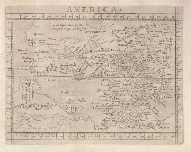
Subject: Western Hemisphere

Period: 1605 (published)

Publication: Le Relationi Universali

Color: Black & White

Size:
10.5 x 7.8 inches
26.7 x 19.8 cm
Download High Resolution Image
(or just click on image to launch the Zoom viewer)

This distinctively engraved map of the Americas is a slightly larger version of the d'Anania and Botero maps used in the earlier editions of this popular work. In North America the Sierra Nevadas are named and Quivira appears both as a region and a large city on the west coast. Another large city labeled Totonteac is shown at the top of the M. Vermeio (Gulf of California). There is a wide St. Lawrence River but no Great Lakes. The legendary settlement of Norimbega, Mocosa (Virginia) and Florida are shown on the eastern seaboard. In the north Atlantic, the imaginary islands of Frislant, Dos Demonios, Sept Cites and St. Brendain are shown. South America is shown with a bulging western coast based on Ortelius, while an outsized La Plata River plunges into the continent. A massive Tierra del Fuego fills the bottom of the map and is connected to an even more massive Nova Guinea. Several recent discoveries are noted in the Pacific including the Ladrones (Guam).

References: Burden #149.

Condition: A

Nice impression with faint printer's ink residue. Issued folding, now flattened, with a small section of the margin extended at lower left to better accommodate framing.

Estimate: $850 - $1,000

Sold for: $900

Closed on 2/25/2009

Archived