Catalog Archive
Auction 127, Lot 500

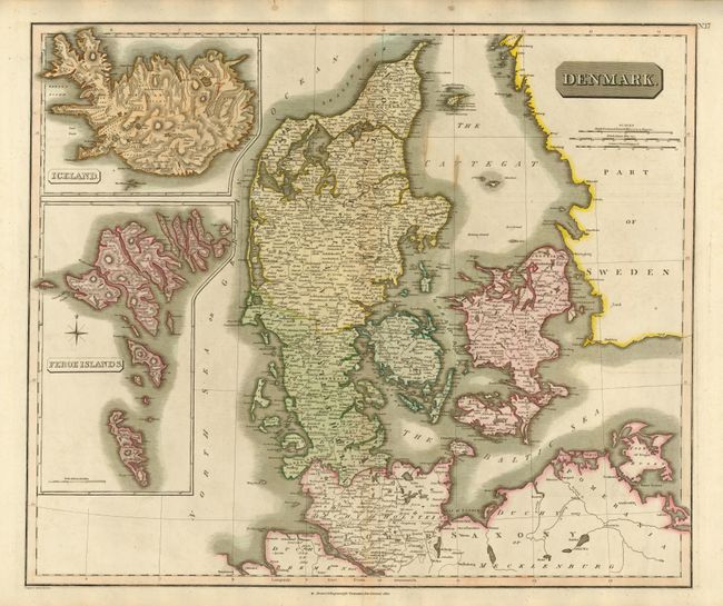
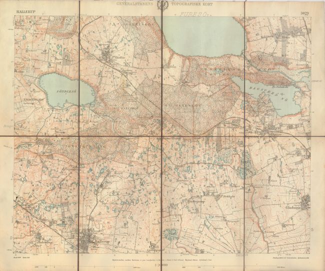
"[Lot of 2] Denmark [and] Generalstabens Topografiske Kort - Hareskov",

Subject: Denmark

Period: 1814-1914

Publication:

Color:

Size:
23.3 x 19.8 inches
59.2 x 50.3 cm
Download High Resolution Image
(or just click on image to launch the Zoom viewer)

1) Denmark, by John Thomson, from the New General Atlas, Edinburgh, 1814 (23.3 x 19.8") hand colored. A large-scale map of Denmark, including Schleswig & Holstein, with insets of the Faroes and Iceland.

2) Generalstabens Topografiske Kort - Hareskov, 1914 (18.5 x 15") printed color. Dissected and linen backed, folding map covering in great detail the Hareskov suburb of Copenhagen. Printed in Danish.

References:

Condition: B+

First with a couple of minor stains, otherwise both are very good.

Estimate: $150 - $200

Unsold

Closed on 2/25/2009

Archived