Catalog Archive
Auction 127, Lot 455

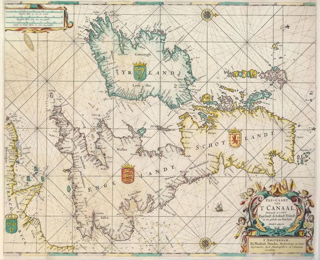
"Pas-Caart van 't Canaal, Vertoonende in 't Geheel Engelandt, Schotlandt, Yrlandt, en een Gedeelte van Vranckryck", Doncker, Henrick

Subject: Britain

Period: 1660 (circa)

Publication: Zee-Atlas

Color: Hand Color

Size:
21.3 x 17.5 inches
54.1 x 44.5 cm
Download High Resolution Image
(or just click on image to launch the Zoom viewer)

This is a very handsome sea-chart of the British Isles with north oriented to the right by two decorative compass roses. Two smaller compass roses show north with the magnetic variation. The map extends to include the English Chanel and coastline of Normandy. Soundings, sand bars, fishing banks and navigational hazards are marked and only coastal place names are located. The map is beautifully decorated with the arms of each nation, a sailing ship and two fine cartouche; the title cartouche is adorned with chubby cherubs using navigational instruments.

References:

Condition: A

The margins have been professionally extended to better accommodate framing, and the map is backed with light Japanese tissue repairing a couple minor tears near the centerfold.

Estimate: $950 - $1,200

Sold for: $1,900

Closed on 2/25/2009

Archived