Catalog Archive
Auction 127, Lot 438

"A New Generall Chart for the West Indies of E. Wrights Projection vut. Mercator's Chart", Moll, Herman
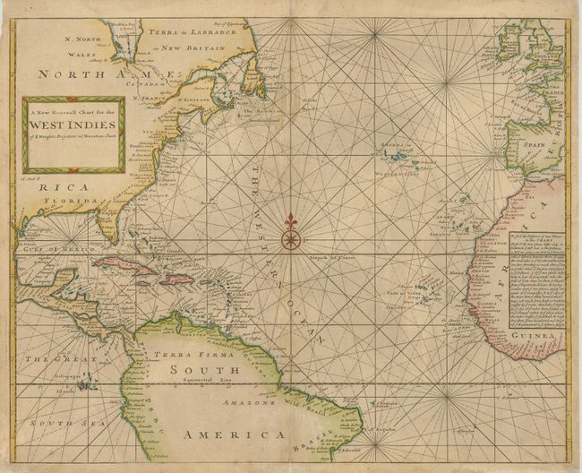
Subject: Atlantic Ocean and West Indies

Period: 1790 (circa)

Publication:

Color: Hand Color

Size:
22.5 x 18 inches
57.2 x 45.7 cm
Download High Resolution Image
(or just click on image to launch the Zoom viewer)

A crisply engraved sea chart covering most of the Atlantic Ocean but, as noted in the title, focusing on the West Indies. Place names are located along the coastal areas of North and Central America with a bit of the northern portion of South America as well as the western coast of Africa and a portion of Europe. The chart is centered on a large compass rose and the title is enclosed in a picture frame-style cartouche. A text panel in the interior of Africa explains the use of the chart. The chart was engraved by Herman Moll as noted below the cartouche. This is an uncommon state without the publisher's imprint below the title in the cartouche; it appears the imprint has been erased from the plate in this example. Other states are known to have been published by Seller & Price with the date 1703, and by Mount & Page in editions of the English Pilot.

References:

Condition: B

Lightly toned with a couple small abrasions on the map and repairs along the centerfold and a short internal tear off the lower centerfold.

Estimate: $475 - $550

Sold for: $350

Closed on 2/25/2009

Archived