Catalog Archive
Auction 127, Lot 360

"Mexico & Guatemala", Mitchell, Samuel Augustus

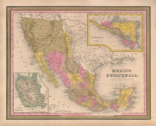
Subject: United States, Texas & Mexico

Period: 1847 (dated)

Publication: Universal Atlas

Color: Hand Color

Size:
14.5 x 12 inches
36.8 x 30.5 cm
Download High Resolution Image
(or just click on image to launch the Zoom viewer)

This uncommon map was registered by H.N. Burroughs in 1846, but was published by Mitchell the following year. The map still shows Texas as an Independent Republic, but it is not individually colored. New Mexico is shown as a small sliver of land between Texas and Upper California, extending north into the western part of present day Colorado. Santa Fe and Taos are in Texas. Upper or New California occupies much of the West, extending into today's western Colorado. The American West extends to the Pacific with Oregon Territory named. Austin appears prominently in Texas as the capitol city, along with Austin's Grant, Houston, Goliad, Loredo, Washington, and several other early settlements. Many Indian tribes are named and located. In its transitional geography, Fremont's Pass is shown and the discoveries of Fremont in the Great Basin region are current, not what we've seen on some other examples of this map also dated 1846. The Pueblo de Los Angeles was missing on earlier examples, but is included here. The missions of California are located and named. Large insets show Guatemala and the Valley of Mexico. Blank verso. The map has Mitchell's imprint below the title, dated 1847, but the Burroughs imprint remains below the map.

References:

Condition: B+

Beautiful original coloring, good impression and full margins. A couple small stains in the Pacific and a light smudge at right border.

Estimate: $250 - $350

Sold for: $130

Closed on 2/25/2009

Archived