Catalog Archive
Auction 127, Lot 34

"Tabula Nova Totius Orbis", Waldseemuller/Fries

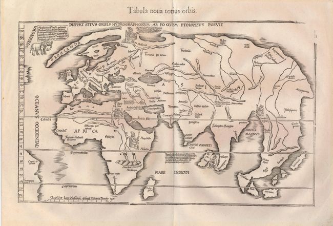
Subject: Ancient World

Period: 1541 (published)

Publication: Claudii Ptolemaei Alexandrini Geographicae

Color: Black & White

Size:
18 x 11.3 inches
45.7 x 28.7 cm
Download High Resolution Image
(or just click on image to launch the Zoom viewer)

This is one of the earliest world maps available to collectors. It is Laurent Fries' reduction of Martin Waldseemüller's 1513 map of the 'modern' world. It shows the world in a combination of classical misconceptions with a few of the more recent discoveries including a bit of the coastline of South America along the left border. Greenland is drawn as an elongated peninsula connected to a still primitively shaped Scandinavia. Fries' adaptation presents the mountains in a different stylized manner and lacks the directional lines of the Waldseemuler plate. He also added five icons of enthroned kings, representing those of Moscovia, Egypt, Ethiopia, Taprobana, and Mursuli. There is also a drawing of an elephant incongruently placed just off the coast of Greenland. The map first appeared in 1522; this being the last state with the title in plain type in the top margin. Another title beneath the top neatline reads, Diefert Situs Orbis Hydrographorum ab eo quem Ptolomeus Posuit. The upper right corner of the border is lacking, as is the case with editions from 1525 to 1541.

References: Shirley #49; Mickwitz & Miekkavaara (Nordenskiold Vol. 2) #211-49.

Condition: A+

Fine with very faint toning in the wide original margins and one tiny binding hole, well away from the map.

Estimate: $4,000 - $4,750

Sold for: $4,250

Closed on 2/25/2009

Archived