Catalog Archive
Auction 127, Lot 316

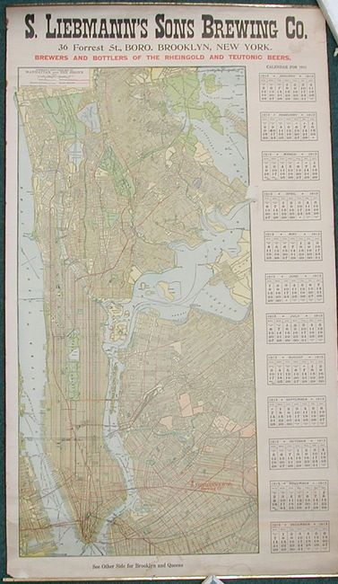
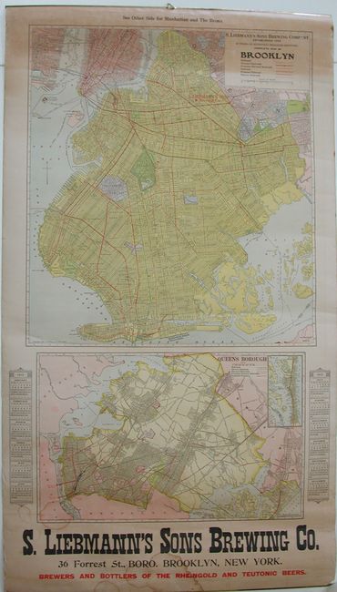
"Hammond's New Guide Map of Manhattan and the Bronx / Complete Map of Brooklyn / Queens Borough", Hammond, C. S.

Subject: New York City

Period: 1912 (dated)

Publication:

Color: Printed Color

Size:
22 x 39 inches
55.9 x 99.1 cm
Download High Resolution Image
(or just click on image to launch the Zoom viewer)

This is a rare double sided advertising wall map. One side has a very detailed and colorful map of Manhattan and the Bronx (16" x 33") with much information including streets, buildings, Central Park, the old Polo Grounds, and more. To the side is a 1913 calendar. The map extends to the boundary with Mount Vernon and Yonkers. On the other side are two maps, the first (19" x 21") is a very detailed map of Brooklyn and below is the Queens Borough (17" x 11") map with the same fine color and similar details. All three maps delineate the routes of railroads with different color and style of line, specifically showing railroads, plus elevated and electric rails and subways. The Brooklyn side has a second calendar to either side of the map of Queens. This advertising wall map was compliments of the S. Liebmann's Sons Brewing Company whose name appears in large block letters on both sides. A red star locates the brewery on the map of Brooklyn. The brewery was a family owned business from the 1850s to the 1970s when they were forced out of business by the large breweries. A scarce advertising wall map.

References:

Condition: B+

The maps have great color and impression. Original metal strips hold the top and bottom with hanger still intact. Some water staining mostly along bottom and an area of toning along top on one side likely from being in contact with something. One area of loss (1/2") at the edge of the Manhattan map in the Throgs Neck area.

Estimate: $375 - $450

Unsold

Closed on 2/25/2009

Archived