Catalog Archive
Auction 127, Lot 299

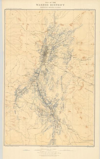
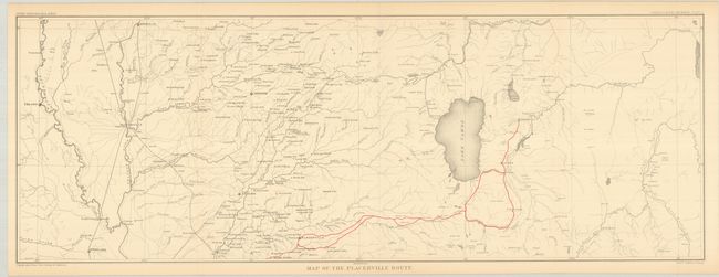
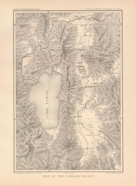
"[Lot of 3] Map of Washoe District Showing Mining Claims [and] Map of the Placerville Route [and] Map of Carson Valley", U.S. Geological Survey (USGS)

Subject: Nevada and California

Period: 1883 (published)

Publication: Comstock Mining and Miners

Color:

Size:
See Description
Download High Resolution Image
(or just click on image to launch the Zoom viewer)

These maps are from Eliot Lord's scarce monograph on Comstock Mining and Miners, published in 1883. This area first drew the interest of gold prospectors in the 1850s. They struggled with the heavy, gooey mud that clung to picks and shovels. When assayed, the troublesome muck proved to contain silver ore worth over $2,000 a ton - in 1859 dollars - not counting the gold content! This rich lode caught the attention of President Lincoln who realized this mineral wealth could help to keep the Union solvent during the Civil War. In 1864 he made Nevada a state, bypassing the sticky problem that it did not contain enough people to be constitutionally eligible for statehood.

1) This remarkably detailed topographical map is updated from Capt. Wheeler's "Outline Map of Washoe District Nev. Showing Comstock Lode" from his "Surveys West of the 100th Meridian" showing a slightly larger area to account for the increased number of claims. It shows the gold and silver operations in the vicinity of Virginia City. It is difficult to overstate the number of claims shown -- perhaps as many as 120 in a patchwork mosaic cover the region so completely it is difficult to see place names. Scores of mills including Sherman, French's, Humphreys, Nevada and many more are identified. The Sutro Tunnel is detailed with the tunnel entrance located. Hundreds of settlements and villages, roads and trails and much, much more are presented. The map attests to the manic mining activities of the day. Folding as issued with a couple small fold intersection splits and one short fold split just into map, closed on verso. (A) (18 x 31.5"), printed color.

2) Red printing illustrates the route from Carson City to Placerville, around Lake Tahoe, and west to the Sacramento River, (28.8 x 10.3"), printed color. Folding as issued. (A+)

3) Delicate hachure defines the topography around Lake Tahoe, (6.8 x 9.8"), b&w. Locates Truckee, Reno, Virginia City, Gold Hill, Silver City, Carson City and Genoa. (A+)

References:

Condition:

See individual descriptions.

Estimate: $100 - $150

Sold for: $60

Closed on 2/25/2009

Archived