Catalog Archive
Auction 127, Lot 297

"Map of Montana", Rand McNally & Co.
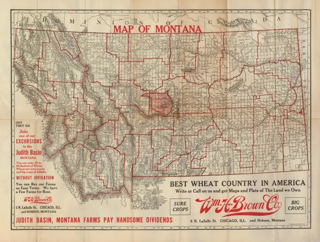
Subject: Montana

Period: 1916 (circa)

Publication:

Color: Printed Color

Size:
22 x 16 inches
55.9 x 40.6 cm
Download High Resolution Image
(or just click on image to launch the Zoom viewer)

This scarce land promotional map shows the entire state but features the Judith Basin -- "Best Wheat Country in America". The basin is highlighted through red overprinting. Published for the Wm. H. Brown Co. of Chicago, the advertising map claims "You can raise 30 to 60 Bushels of Winter Wheat per acre yearly and big crops of Alfalfa WITHOUT IRRIGATION" in red overprinting. Yellowstone is shown in good detail as is the watershed, topography, roads, towns, railroads, etc. All counties outlined by red overprinting. County development shows Phillips (1915), but not Carter (1917) counties. Blank verso.

References:

Condition: B+

Folding, as issued. A little toning along horizontal fold line with one split with tiny loss at fold intersection.

Estimate: $100 - $140

Sold for: $60

Closed on 2/25/2009

Archived