Catalog Archive
Auction 127, Lot 269

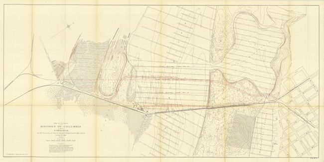
"Map of Portions of District of Columbia and Virginia in the Vicinity of the Proposed Highway Bridge above Long Bridge", U.S. Government

Subject: District of Columbia

Period: 1901 (dated)

Publication: Highway Bridge Report, October 25, 1901

Color: Printed Color

Size:
48.3 x 23.5 inches
122.7 x 59.7 cm
Download High Resolution Image
(or just click on image to launch the Zoom viewer)

This highly detailed chart, drawn on a scale of 200' per inch, extends from Arlington Junction eastward to Maryland Avenue. It shows the planned Highway Bridge over the Potomac River, completed in 1906 and later replaced by the current 14th Street Bridge. Also shows the proposed Railroad Bridge just south of the Highway Bridge. Delineates the tracks of the WA. & Mt. V. R.R. and the Washington Southern Railroad. The existing Long Bridge just south of the two proposed bridges is well shown. The river is filled with a dense grid of soundings. Published by Norris Peters.

References:

Condition: A

Folding as issued. One horizontal fold with light toning, otherwise fine.

Estimate: $80 - $120

Unsold

Closed on 2/25/2009

Archived