Catalog Archive
Auction 127, Lot 264

"Map of Colorado Territory Compiled from Government Maps & Actual Surveys", U.S. State Surveys
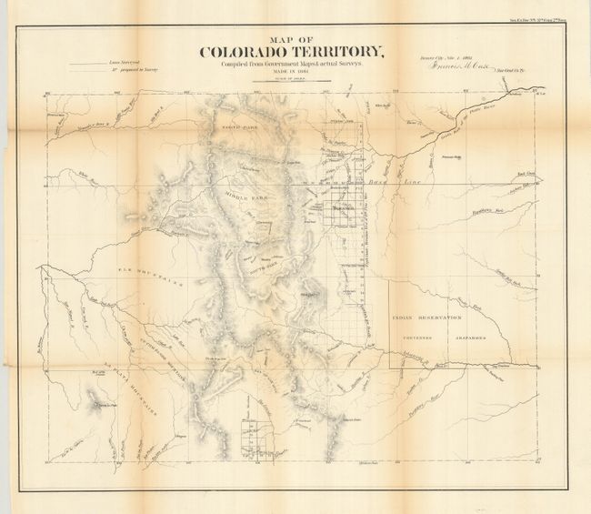
Subject: Colorado

Period: 1861 (dated)

Publication: HR Ex. Doc. No. 1, 37th Cong., 2nd Sess.

Color: Black & White

Size:
20.8 x 17.7 inches
52.8 x 45 cm
Download High Resolution Image
(or just click on image to launch the Zoom viewer)

This is the first official map of Colorado. It is signed in the plate "Denver City Nov. 1st 1861. Francis M. Case Sur. Genl. Co. Ty." The map has good detail considering this early attempt at mapping the territory. Details include watershed, mountains in hachure, and survey status shown along the plains just east of the Front Range. The towns of Denver, Colorado City (Colorado Springs), Boulder City, Golden City, Pueblo, Canon City, Breckenridge, Central City, Ft. St. Vrain are shown. Mountains named include Pike's Peak, Longs Peak, Spanish Peaks, etc. The map is centered on the San Luis Valley and the parks - South, Middle and North. In the plains is the Indian Reservation divided between the Cheyennes and Arapahoes. An important map that should be in any collection of Colorado maps.

References: Ellis #17.

Condition: B+

Some fold toning, more in upper left, and a little archival tape on some folds for reinforcement. Folding as issued.

Estimate: $500 - $600

Sold for: $475

Closed on 2/25/2009

Archived