Catalog Archive
Auction 127, Lot 247

"Colton's Territories of New Mexico and Utah", Johnson & Browning

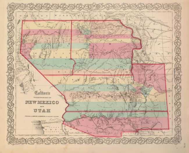
Subject: Southwestern United States

Period: 1859-60 (published)

Publication: Illustrated Family Atlas

Color: Hand Color

Size:
15.6 x 12.8 inches
39.6 x 32.5 cm
Download High Resolution Image
(or just click on image to launch the Zoom viewer)

This is the scarce issue of Colton's great map of the American Southwest featuring the provisional territory of Colona, which became Colorado in 1861. Both the territories of Utah and New Mexico are shown in a transitional state. The proposed territory of Arizona is shown to the south of New Mexico. The newly proposed territory of Nevada is shown taking in the western part of Utah with the border at the 114th meridian, but wandering south-southeast from Preuss L. to form a boundary along the Spanish Trail. The engraver has not changed the Utah label so 'Utah' stretches across both territories with Nevada identified only in small letters below. Further east is part of Kanzas and Nebraska. The map locates numerous early exploration routes, mail routes and proposed routes for the Pacific Railroad, and much more. Surrounded by Colton's distinctive scroll border. Dated 1855, this is the rare 8th state of the map, published circa 1859-60.

References: Brown (Portolan - Spring 2005) pp. 48-51; cf Wheat (TMW) #832.

Condition: B+

Exceptionally fine impression and original coloring with wide margins. Small loss at upper margin expertly repaired. One small area of marginal foxing that just enters the border.

Estimate: $425 - $550

Sold for: $800

Closed on 2/25/2009

Archived