Catalog Archive
Auction 127, Lot 217

"North Carolina South Carolina and Georgia", Jocelyn, N. & S. S.

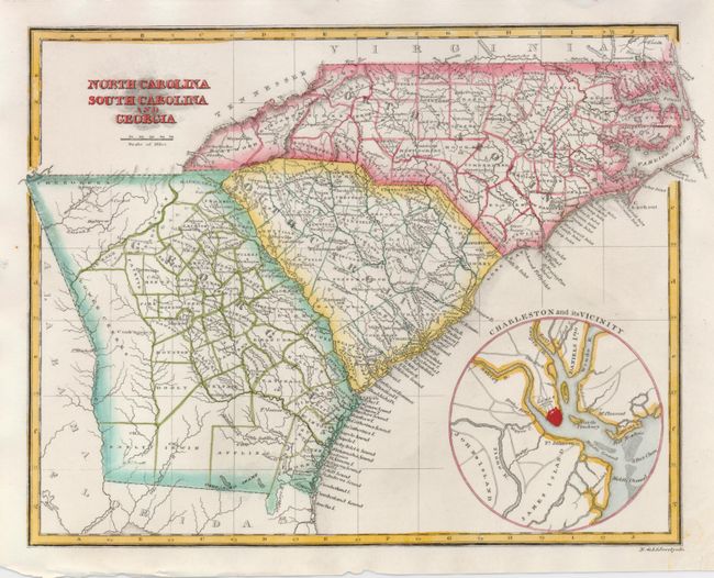
Subject: Southeastern United States

Period: 1825 (circa)

Publication:

Color: Hand Color

Size:
9.8 x 7.7 inches
24.9 x 19.6 cm
Download High Resolution Image
(or just click on image to launch the Zoom viewer)

Very detailed engraved chart locating all counties, watershed, some topographical information, and more. An uncommon circular inset "Charleston and its Vicinity" extends to include John's, James and Daniels Islands, and Fort Moultrie, the Ashley River and more. It also locates Castle Pinckney, the "Forgotten Fort" in Charleston Harbor. The fort was constructed sometime prior to the War of 1812 on Shutes Folly, a marshy island just offshore from Charleston. Seeing no action in the War of 1812, it was abandoned for many years. It was then 'regarrisoned' during the Nullification Crisis of 1832 by President Jackson in a conflict over the tariff rates. The fort was thereafter used as a storehouse for powder and other military supplies. On December 27, 1860, just a week after South Carolina seceded from the Union, the lone solider manning the fort was forced to surrender Castle Pinckney to South Carolina. This makes Castle Pinckney the first U.S. fort taken over by a Southern Government.

References:

Condition: A

Fine less a small tear and light stain in tip of lower right corner. Map image and color are fine.

Estimate: $100 - $140

Sold for: $180

Closed on 2/25/2009

Archived