Catalog Archive
Auction 127, Lot 203

"A Map of Georgia, also the Two Floridas, from the best Authorities", Morse, Jedidiah (Rev.)

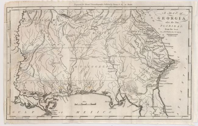
Subject: Southern United States

Period: 1796 (published)

Publication: Morses's Universal Geography

Color: Black & White

Size:
12 x 7.5 inches
30.5 x 19.1 cm
Download High Resolution Image
(or just click on image to launch the Zoom viewer)

This is an early American map depicting Georgia Territory extending from the Atlantic seaboard to the Mississippi River, with East and West Florida along the Gulf Coast. Most of the interior is dominated by various Indian tribes, including the Chickasaws, Creeks, Chactaws, and Muskogees, and several prominent villages are located. Some early counties are shown along the Atlantic coast and the Savannah River. Several trading paths are noted in the west. Mobile, Pensacola, and New Orleans are noted. Engraved by Amos Doolittle.

References: Wheat & Brun #614.

Condition: B

Generally a very good example but with a couple fold splits and a long tear at left crosses border and enters map. Expertly repaired with full backing on verso.

Estimate: $300 - $400

Sold for: $550

Closed on 2/25/2009

Archived