Catalog Archive
Auction 127, Lot 182

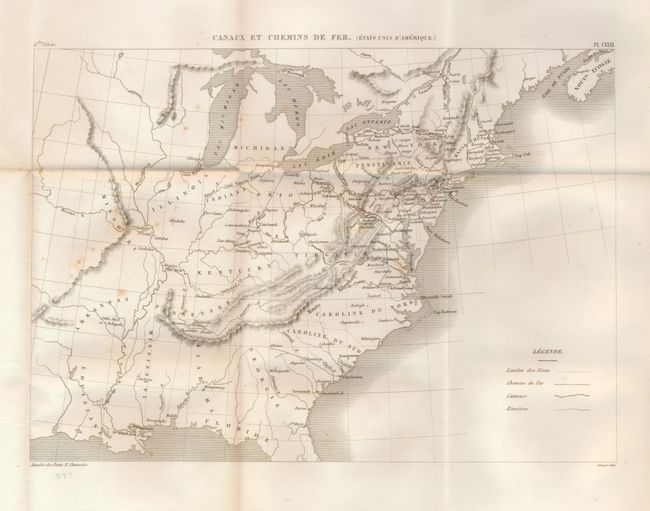
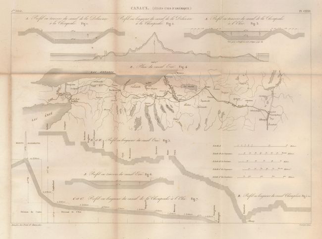
"[Lot of 2] Canaux et Chemins de Fer (Etats Unis d'Amerique) [and] Canaux. Plan du Canal Erie",

Subject: Eastern United States

Period: 1837 (published)

Publication: Annales des Portes et Chausees, Tome XX

Color: Black & White

Size:
13.5 x 9.8 inches
34.3 x 24.9 cm
Download High Resolution Image
(or just click on image to launch the Zoom viewer)

Two rare and very early maps detailing railroads and canals in the United States. The first extends to Arkansas and Missouri. It shows railroads from Charleston to Athens, two in Virginia and several in the Northeast and Mid-Atlantic area. The short line originating in Montgomery, Alabama is the railroad furthest west. The second map is a detailed chart of the canal between Buffalo and Albany, with cross-sections and elevation profiles. It shows a short railroad between Albany and Schenectady. Neither map is in Modelski and we find no other references. Size given is approximate for both.

References:

Condition: B+

Both folding as issued. The first has a little light foxing in left half. The second is very good (A).

Estimate: $80 - $120

Unsold

Closed on 2/25/2009

Archived