Catalog Archive
Auction 127, Lot 153

"Route from Fort Ellis Montana to Fort Hope, British Columbia Traveled by General Sherman July and August 1883…", U.S. Government

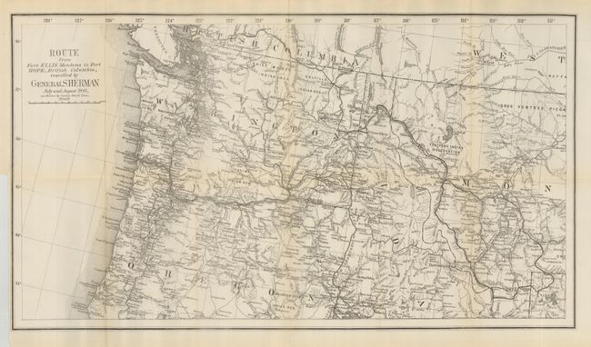
Subject: Canada & Northwestern United States

Period: 1883 (dated)

Publication: Report of Secretary of War, 48th Congress, 1st Session

Color: Black & White

Size:
27 x 15 inches
68.6 x 38.1 cm
Download High Resolution Image
(or just click on image to launch the Zoom viewer)

This map details in a heavy dark line General Sherman's route from Yellowstone to Fort Hope, B.C. He led his troops through the sites of many native battles in his final year as the Head of the Army, retiring in November of 1883. The map has fine detail of watershed in the Northwest. It extends as far east as Bozeman to show most of Yellowstone National Park, and south to show Point Orford in Oregon. Roads, Indian reserves, towns, rivers and the rail lines are noted.

References:

Condition: B+

Folding as issued. Just a little light fold toning otherwise a fine example.

Estimate: $150 - $200

Sold for: $190

Closed on 2/25/2009

Archived