Catalog Archive
Auction 127, Lot 128

"A Map of the British and French Settlements in North America", Hinton, John

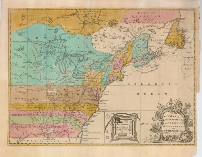
Subject: Colonial United States and Canada

Period: 1755 (published)

Publication: Universal Magazine

Color: Hand Color

Size:
14.8 x 10.8 inches
37.6 x 27.4 cm
Download High Resolution Image
(or just click on image to launch the Zoom viewer)

This is one of several similar maps illustrating the growing French/British conflict in North America. It was issued just before the French and Indian War was officially declared and depicts the British and French settlements and forts (delimited with dotted lines and uncolored) in the disputed territory west of the Allegany Mountains. The British colonies south of the Bounds of Virginia and New England 1606 extend to the western-most edge of the map, which is about the 100th Meridian. Earl Granville's Property is shown in North Carolina, and Georgia is shown as a separate strip with parts of South Carolina both north and south of it. Next to the decorative title cartouche is an inset map of "Fort Frederick at Crown Point built by the French 1731."

References: Jolly UNIV-45; Sellers & Van Ee #36

Condition: B

Strong original color with light even toning. Trimmed to neatline at lower right for binding and a 1" binding tear with small loss of neatline closed on verso with archival tape.

Estimate: $550 - $650

Sold for: $600

Closed on 2/25/2009

Archived