Catalog Archive
Auction 127, Lot 115
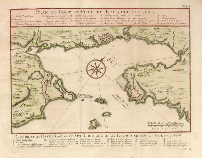
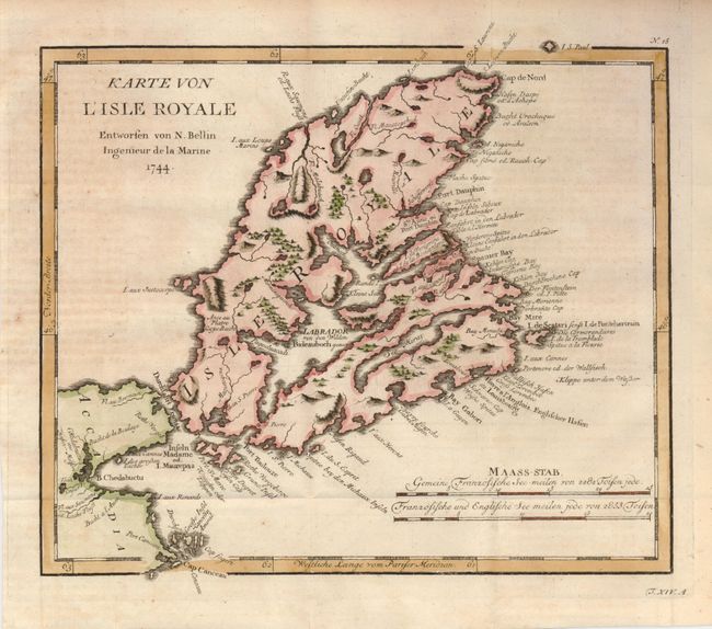
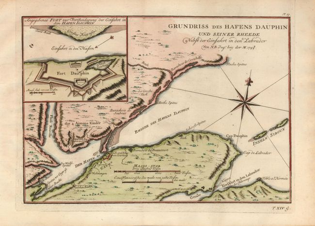
"[Lot of 3] Plan du Port et Ville de Louisbourg dans l'Isle Royale [and] Karte von l'Isle Royale Entworfen [and] Grundriss des Hafens Dauphin und Seiner Rheede", Bellin, Jacques Nicolas
1 of 3
Subject: Canada, Cape Breton Island
Period: 1756 (published)
Publication: Allegmeine Historie der Reisen zu Wasser und zu Lande
Color: Hand Color
Size:
10.6 x 9 inches
26.9 x 22.9 cm
Download High Resolution Image
(or just click on image to launch the Zoom viewer)
(or just click on image to launch the Zoom viewer)